ArcGIS Tools

StoryMaps
Want to make a map that will help you share the stories being uncovered through your research and make them accessible to a broader audience? Want to give your students an opportunity to engage with spatial thinking and work on an exciting digital project? ArcGIS StoryMaps allows you to weave an inspiring and interactive narrative by combining text, maps, and multimedia content – photos, videos, and audio – to communicate information through engaging and user-friendly web mapping applications. |
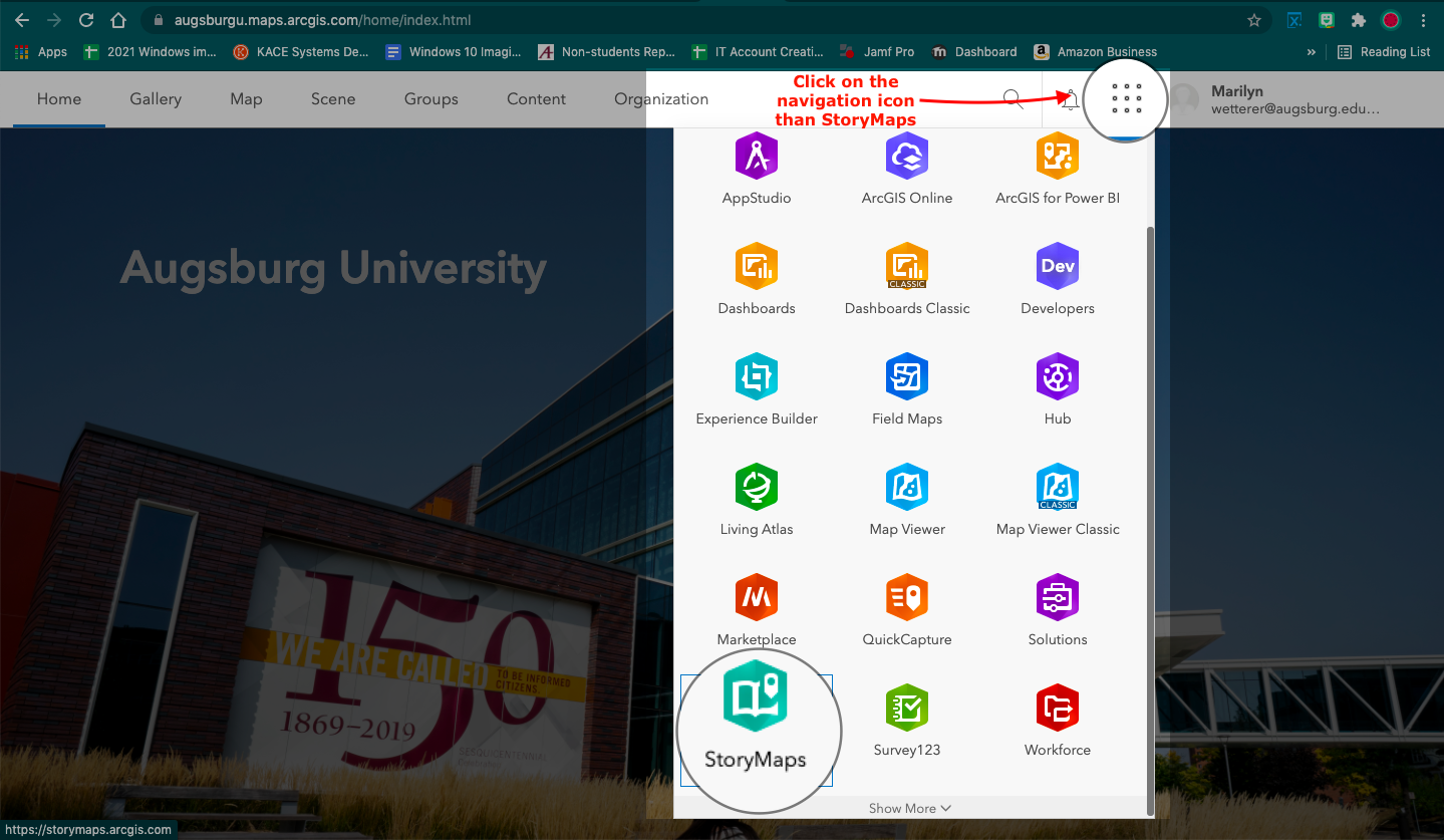
To access StoryMaps at https://augsburgu.maps.arcgis.com or click the ArcGIS link in Moodle, then click on the navigation icon, then click StoryMaps.
Learn More About Creating StoryMaps in ArcGIS
Discover Possibilities with StoryMaps
Gallery of StoryMaps to Explore
Timelines
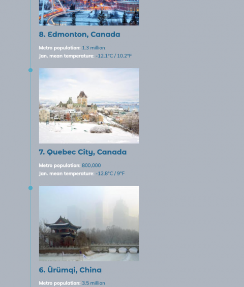
ArcGIS StoryMaps timeline block! This block provides a fun and intuitive way to add chronological visualizations to your story in a more flexible and dynamic presentation than static images or purely text-based lists can offer. Storytellers can enter up to 20 “events” in a vertical chain, and can accompany each event with an image, if desired. You can also add a spacer in between events if you want to indicate that a particular lapse in time is longer relative to others. |
More to come!
The timeline block is still in its beta phase and isn’t a finished product. In the future, look for more layout possibilities, including the exciting prospect of creating timelines horizontally in addition to the vertical layouts.
Mapping
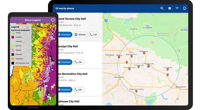
An ArcGIS web map is an interactive display of geographic information that you can use to tell stories and answer questions. For example, you may find or create a map that addresses the question, How many people in the United States live within a reasonable walk or drive to a supermarket? This map might have layers showing which neighborhoods are within a 10-minute drive or 1-mile walk to a supermarket, and for context, the map would have a topographic basemap that includes cities, roads, and buildings overlaid on land cover and shaded relief imagery. |
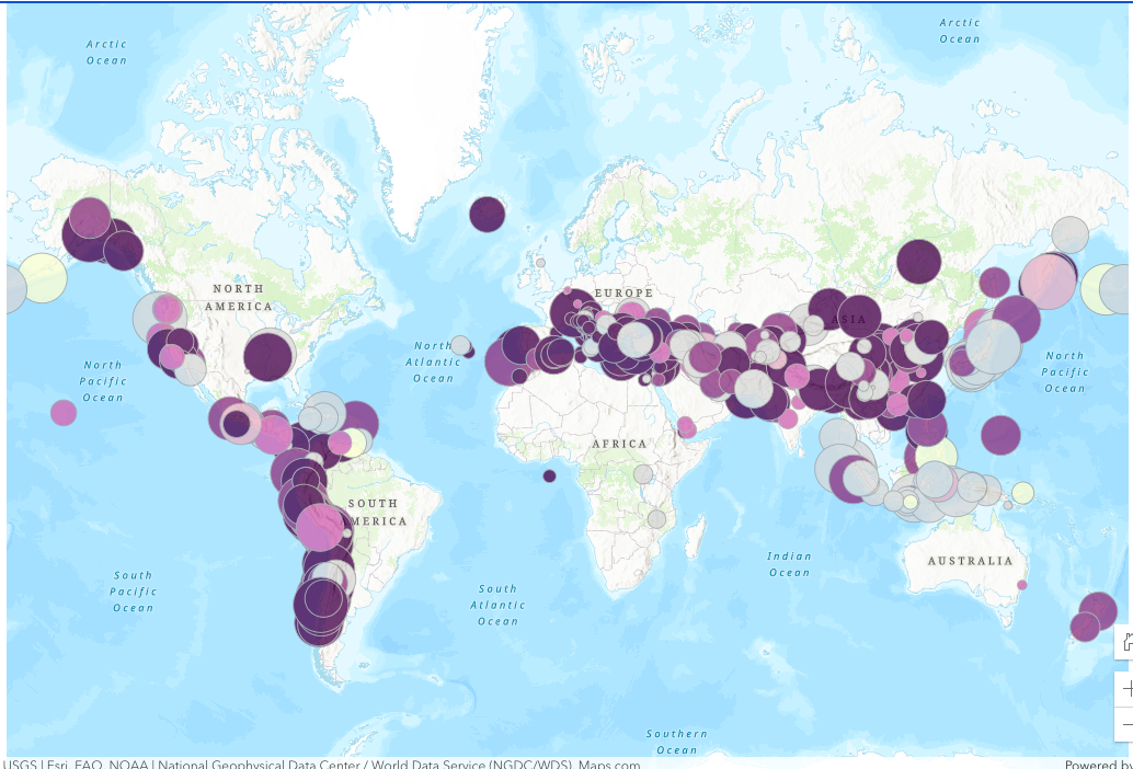
(Example of the map above shows the relative magnitude of earthquakes.)
Maps can be created in a few basic steps and opened in standard web browsers, mobile devices, and desktop map viewers. They can be shared through links or embedded in websites, and used to create map-based web apps. When a map is shared, the author decides what to include with the map. For example, when the map is shared with the general public through Map Viewer or Map Viewer Classic, the map includes options to switch basemaps; view a legend (if the map contains one); view details about the map; share, print, and measure the map; and find locations on the map. Signing in to Map Viewer or Map Viewer Classic with an ArcGIS account may reveal additional options for adding layers, getting directions, and so on. Maps embedded in websites and shared through apps often contain a focused set of tools for a specific purpose, such as collecting information, editing features, or comparing two maps side-by-side.
Creating Apps
ArcGIS Web AppBuilder is an intuitive what-you-see-is-what-you-get (WYSIWYG) application that allows you to build web apps without writing a single line of code. It includes tools to configure fully featured HTML apps. As you add your map and tools, you can see them in the app and use them right away. |
You can do the following with Web AppBuilder:
- Create HTML and JavaScript apps that run on any device.
- Build the apps you need using ready-to-use widgets.
- Customize the look of your apps with configurable themes.
- Host your apps online or run them on your own server.
- Create custom app templates.
Web AppBuilder allows you to create 2D and 3D apps by accessing workflow tabs including Theme, Map or Scene, Widget, and Attribute.
More Resources
Lesson Gallery - Filter for ArcGIS Online
https://go.augsburg.edu/arcgisoverview