Vegetation surveys on La Palma – with Dr Katy Chamberlain (Teesside University, UK)
Introduction and Rationale
Lava flows are fresh rocks that can be colonized by vegetation over time. Though this can be a long process, it is important to understand how various types of vegetation may colonise lava flows and over what timescales, to be able to monitor the development of vegetation on lava flows. In this study, the vegetation of lava flows was investigated for lava flows of different ages on the Canary Island of La Palma.
The amount and maturity of vegetation of lava flows from eruptions in 1677, 1949, and 1971 were noted and described to understand how vegetation differs with the age of lava flows and within different locations. Multiple areas of 1 x 1 m^2 were studied on each lava flow to gain an insight into the vegetation that might be growing on the lava flows from last year, the 20th century and nearly 500 years ago.
Geologic Setting and Eruptive History
The Cumbre Vieja is an active 25-km long volcanic ridge (from 28°42’18” N, 17°50’44” W, elevation of 2058-m to 28°27’30” N, 17°50’37” W, elevation of 79 m) on the southern flank of the island La Palma in the Canary Islands. There are approximately 67,839 people who live on either side of the ridge and therefore are vulnerable to volcanic eruptions.
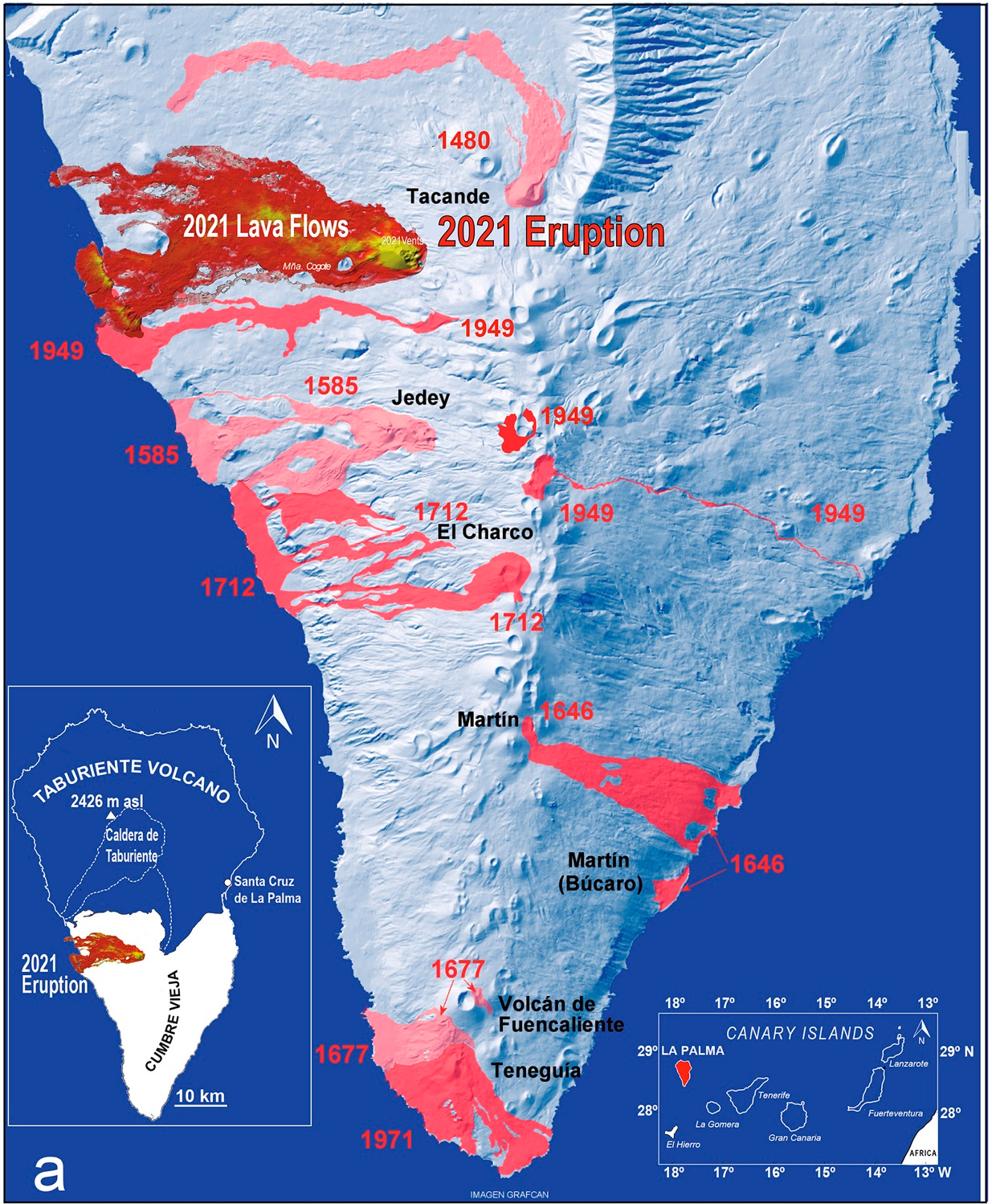
Within the last 450 years, there have been seven recorded volcanic eruptions on La Palma, all of which have produced both lava flows and variable volumes of tephra with eruptions in 1677 and 1949 having phreatomagmatic phases (Figure 1). Furthermore, the latest eruption in 2021 produced both effusive Hawaiian-style lavas, and more explosive, tephra-producing phases. Eruptions are more prominent on the western flank of the ridge, except for the eruptions in 1646 and 1949 which occurred on the eastern flank.
Methods
Surveyable points on all four lava flows were identified. The boundaries of the lava flows were surveyed as well as five meters into the lava flows. The quadrant sections were chosen at random.
The sections of lava surveyed were chosen based on accessibility from nearby roads. Upon reaching the edges of the lava flows, the 1 x 1 m^2 quadrants were placed on the lava at random and the features of the rocks as well as the presence of any vegetation were recorded (Figure 2). This was repeated at least six times at each lava locality. The lavas surveyed included the 1677 eruption, the 1949 and the 1971 lavas.
The lavas were surveyed at low, mid and high altitudes to ascertain whether there were any differences in vegetation at different points along the lava flows.
The criteria that were noted included: location, date and time, surface description, rock description and presence of vegetation (description of what vegetation, surface coverage, and direction).
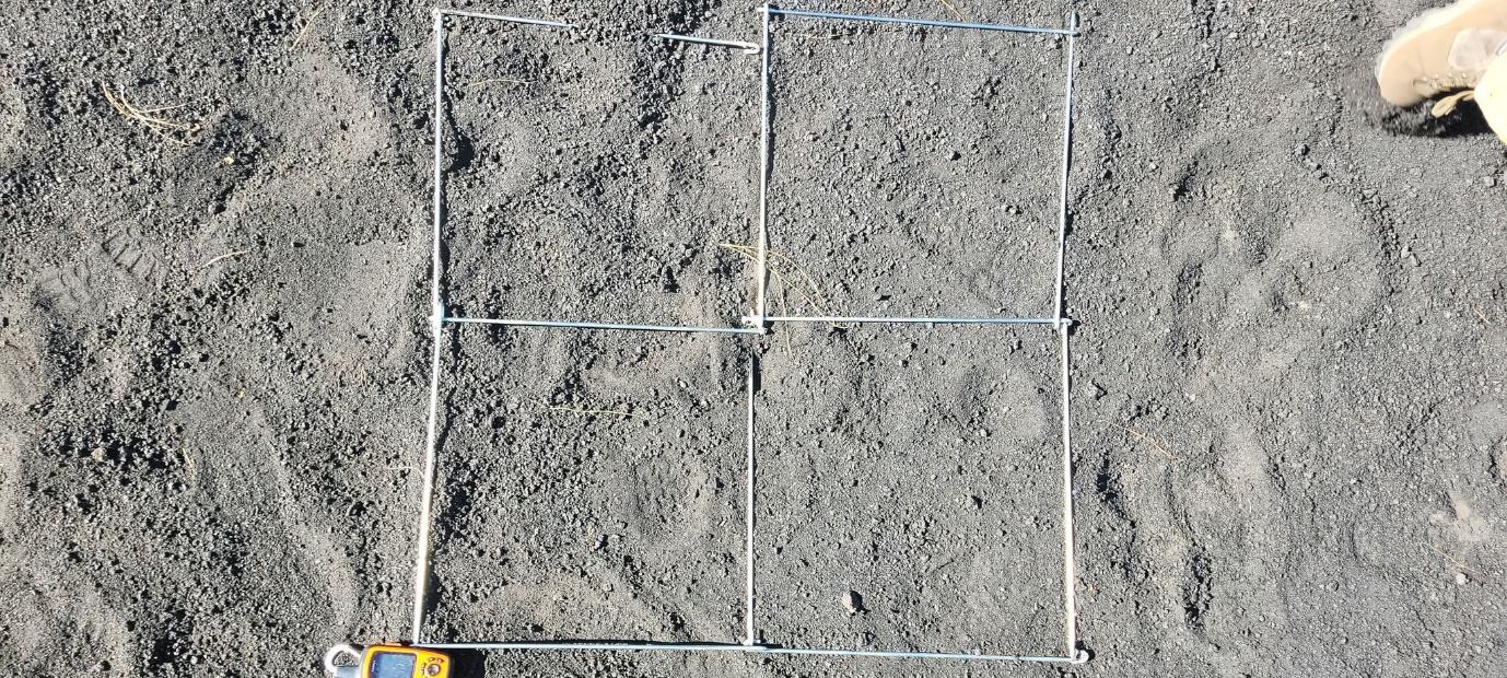
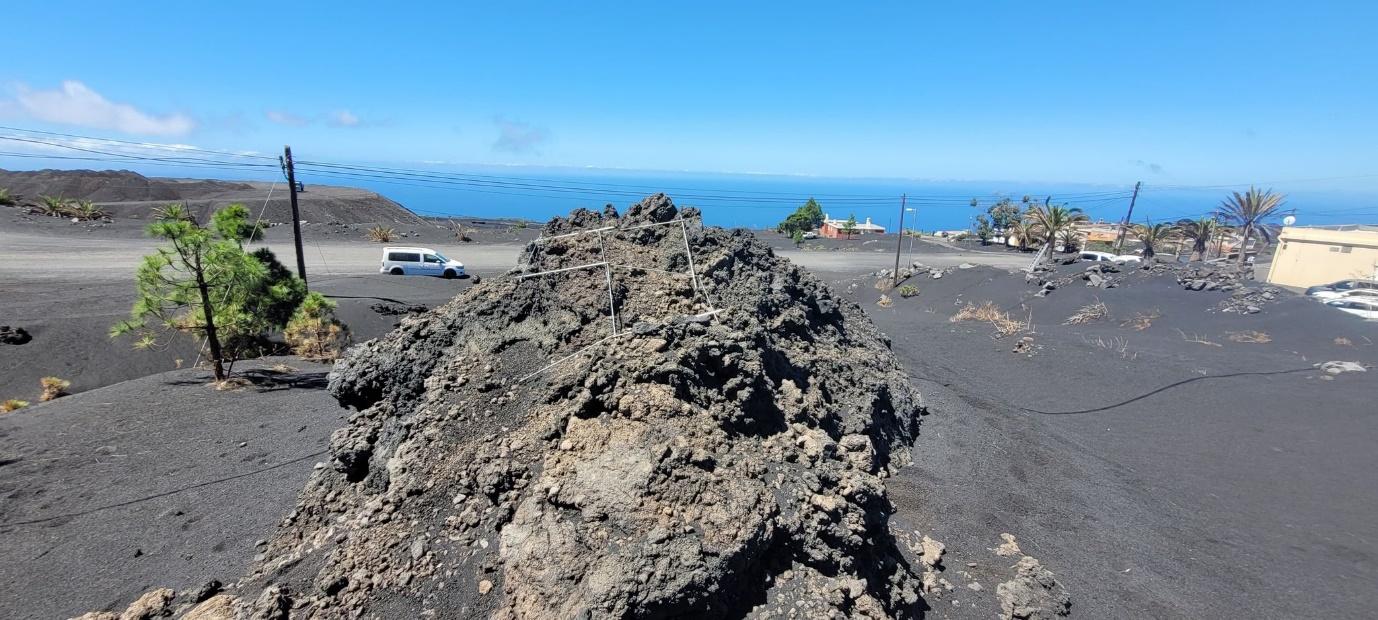
Figure 2: Examples of the laying of the quadrats at various points along the lava flows and in tephra at the lava flow edges. The grids are 1m x 1m, in 50cm segments.
References
Carracedo, J.C., Troll, V.R., Day, J.M., Geiger, H., Aulinas, M., Soler, V., Deegan, F.M., Perez‐Torrado, F.J., Gisbert, G., Gazel, E. and Rodriguez‐Gonzalez, A., 2022. The 2021 eruption of the Cumbre Vieja Volcanic Ridge on La Palma, Canary Islands. Geology Today, 38(3), pp.94-107.