FoxyMCRider Trail Guides 2023 - extremely well documented MC adventures.
Ride > track > video > share
My top 30 fav photos from Adventures >
https://docs.google.com/document/d/1D_d16nr_d8UHVjKjEEmC7TruMkZtf8U_E8EHVV8khk4/edit?usp=sharing
INDEX of routes/rides
ROUTE DESC: From Utah to Banff Jasper Canada
ROUTE DESC: Green River Dirt Bike Rally
ROUTE DESC: From Utah to Banff Jasper Canada
RECAP/SUMMARY/Ride Reflections:
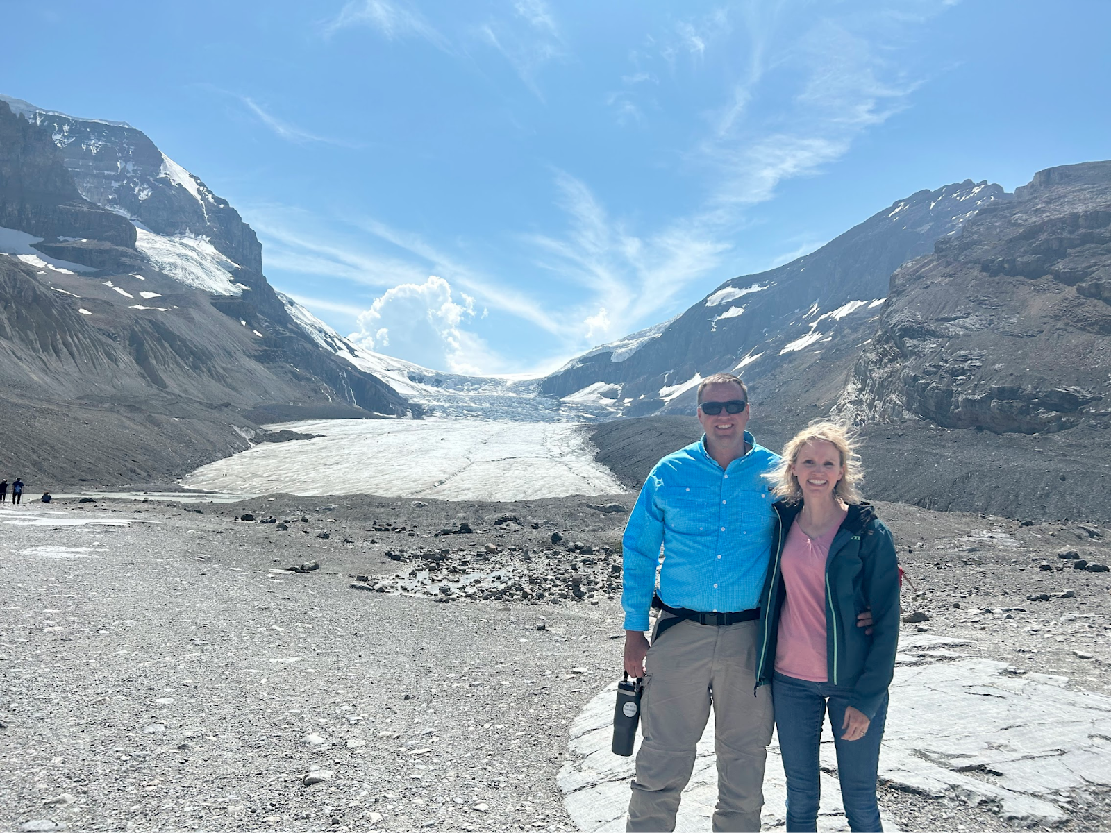
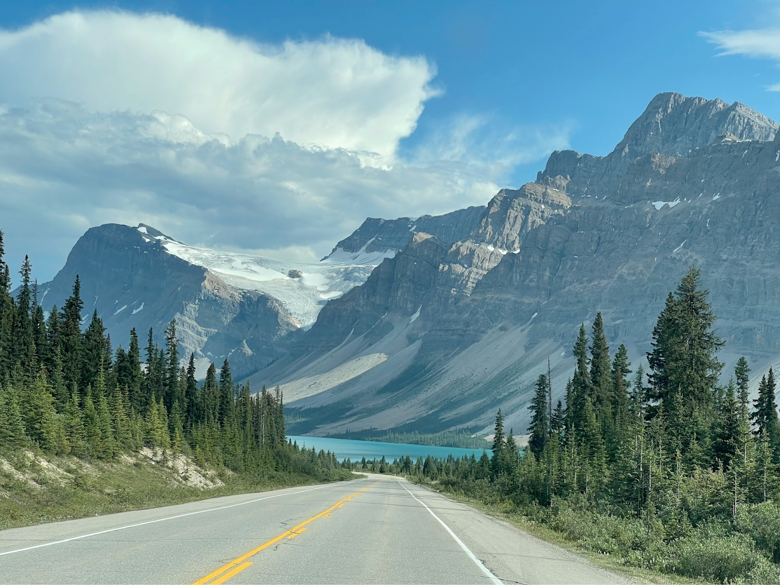
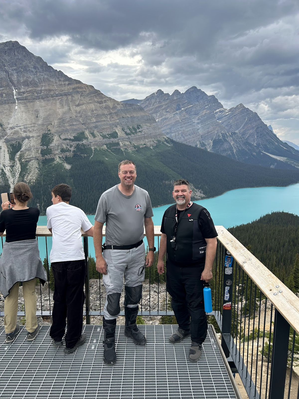
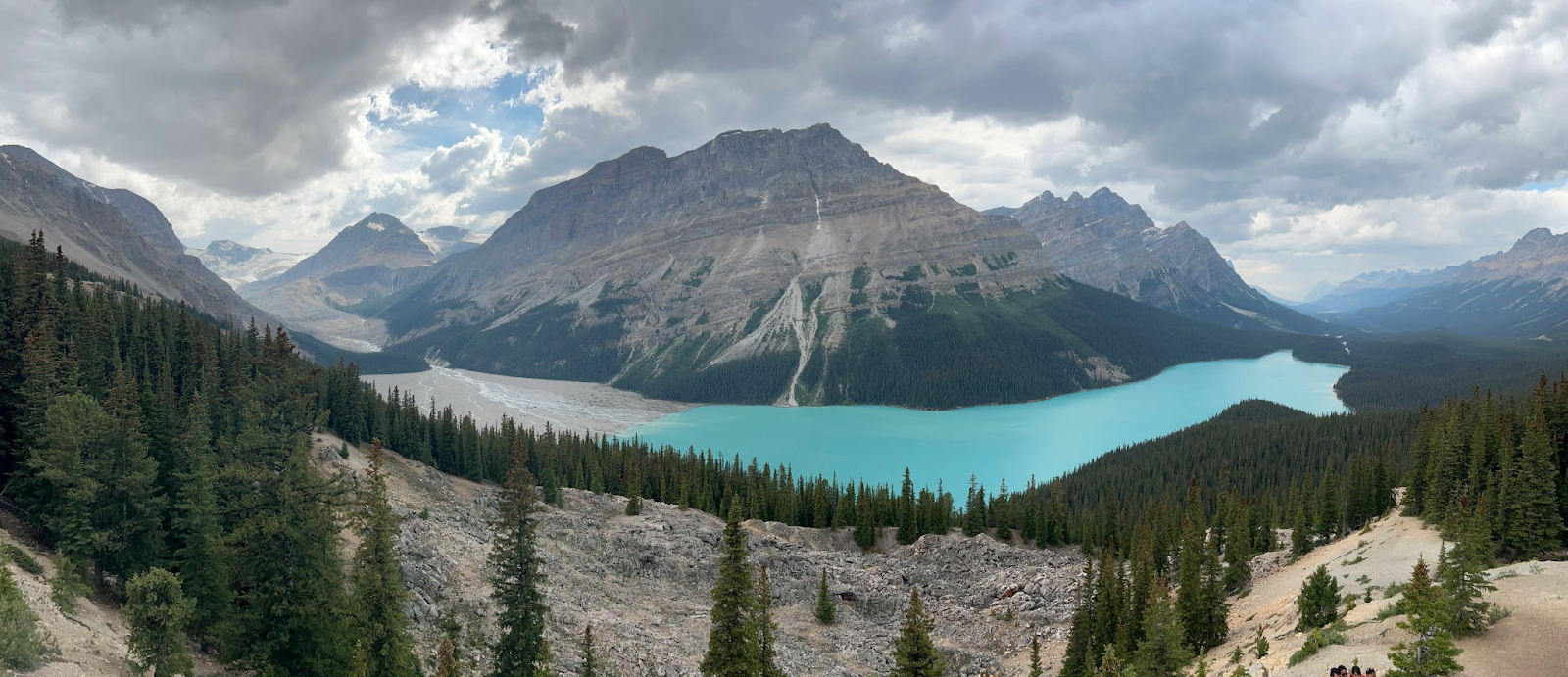
I saw the most beautiful place I’ve ever seen at Banff (Peyto Lake overlook, seeing glacier parkway for at least 50 miles).
We zig zagged on the way up there and got to see some epic back roads of Idaho, Canada, Montana!
METRICS:
Two riders on 1200CC bikes for a 10 day ride, July 5-15th.
3300 miles! Its 2800 miles from Seattle to NY!
bears=3, Thomas got within 10’ of one and asked Mr Bear if he wanted to race my bike, fortunately Mr Bear kept eating berries.
elk=5 ish
Deer = dozens, a couple really close at really high speeds. One required standing bike up on a corner and squeezing the front/rear brakes. This was Thomas biggest concern of the trip, hitting deer, he tends to attract them
Bighorn sheep, two dozen ISH and a couple within 15’
Mountain Goats, two dozen ish and one within 15’, not as close as a couple of years ago (5’)
eagles/hawks= a handful
10 lbs squirrels= dozen
Bison= likely over 400 hundred.
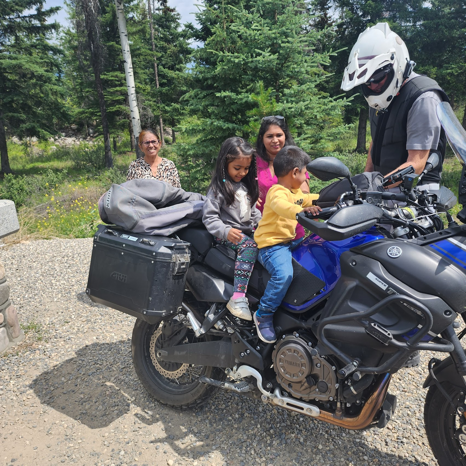
Helpful and amazing people = dozens, including a stranger that lent us her car so we could view the bison range in Ronan MT (motorcycles not allowed…for risk reasons).
Wild tent camping =1
Rv tent camping = 3
Glaciers seen= hundreds
National borders crossed=2
Glacier water drank? 3 times
Sketchy planks crossed over glacier rivers=2, in order to get up onto the glacier “ice fields”
Glaciers walked on=1
Amazing healing and renewal seeing God moving in his majesty and power.= thousands of breath taking beautiful scenery
Photos take= 700 ish
Gopro GB = at least 1 TB
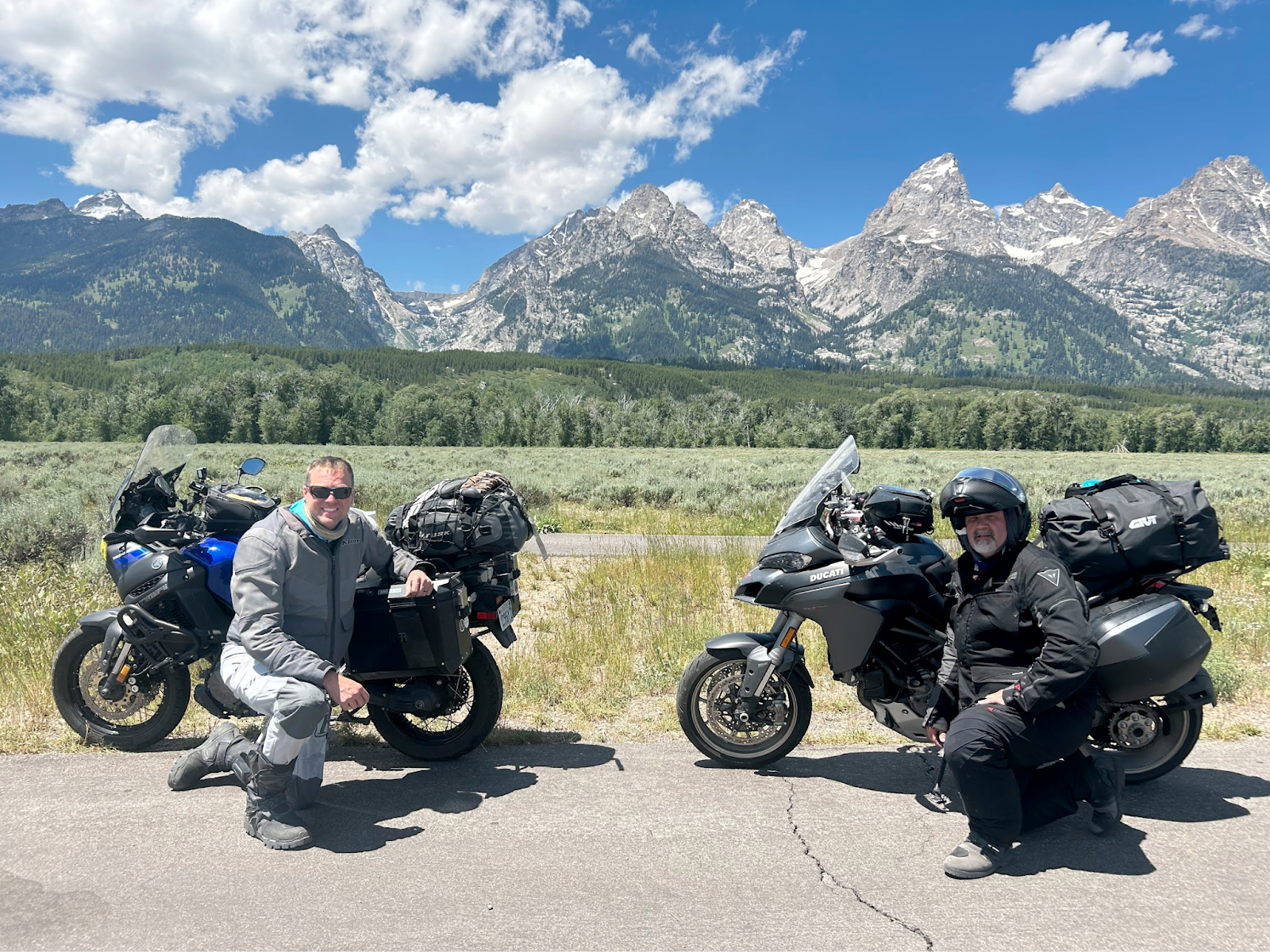
Parks: 7 ish Craters of the moon, Glacier NP, Banff, Jasper, Bear tooth pass, chief Joseph HWY, yellowstone, teton and swan valley.
Audio hours listened to: 40 ish hours, most of that devotionals/spiritual.
BASIC ROUTE:
DAY1 (wed):
From Saratoga Springs, UT > Blackfoot ID > arco ID > craters of the Moon > Challis ID (Camped at cool RV park with hot springs).
DAY2(thur): Left Challis Idaho > lunch in Salmon ID > Bitterroot > Missoula > Bison Range near St Ignatius > dinner in Poulson on the Flathead lake > Camped at Blue Bay on Flathead lake.
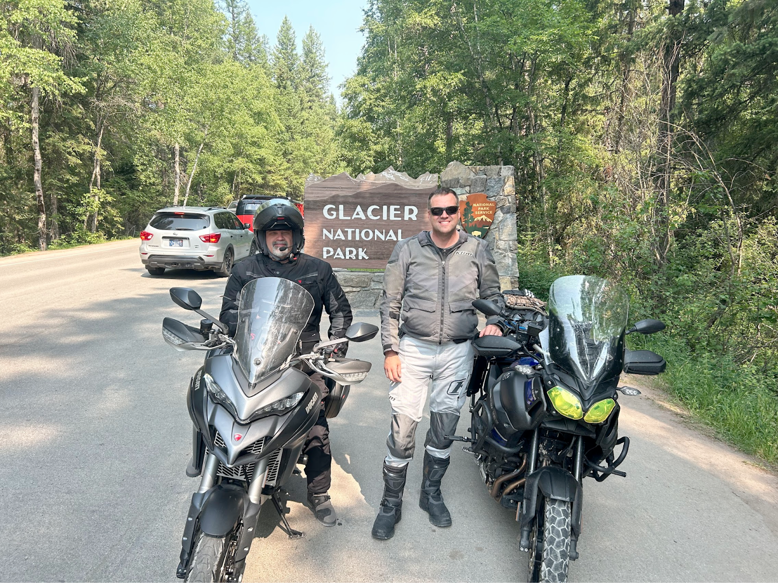
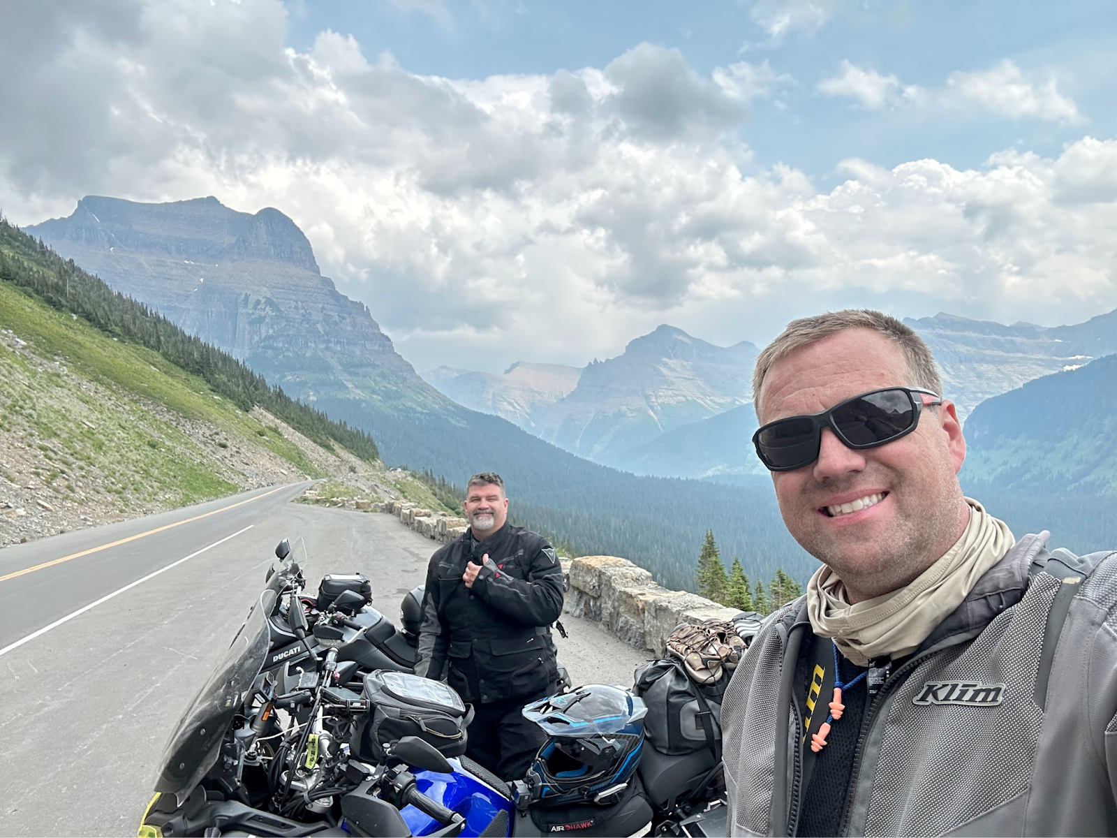
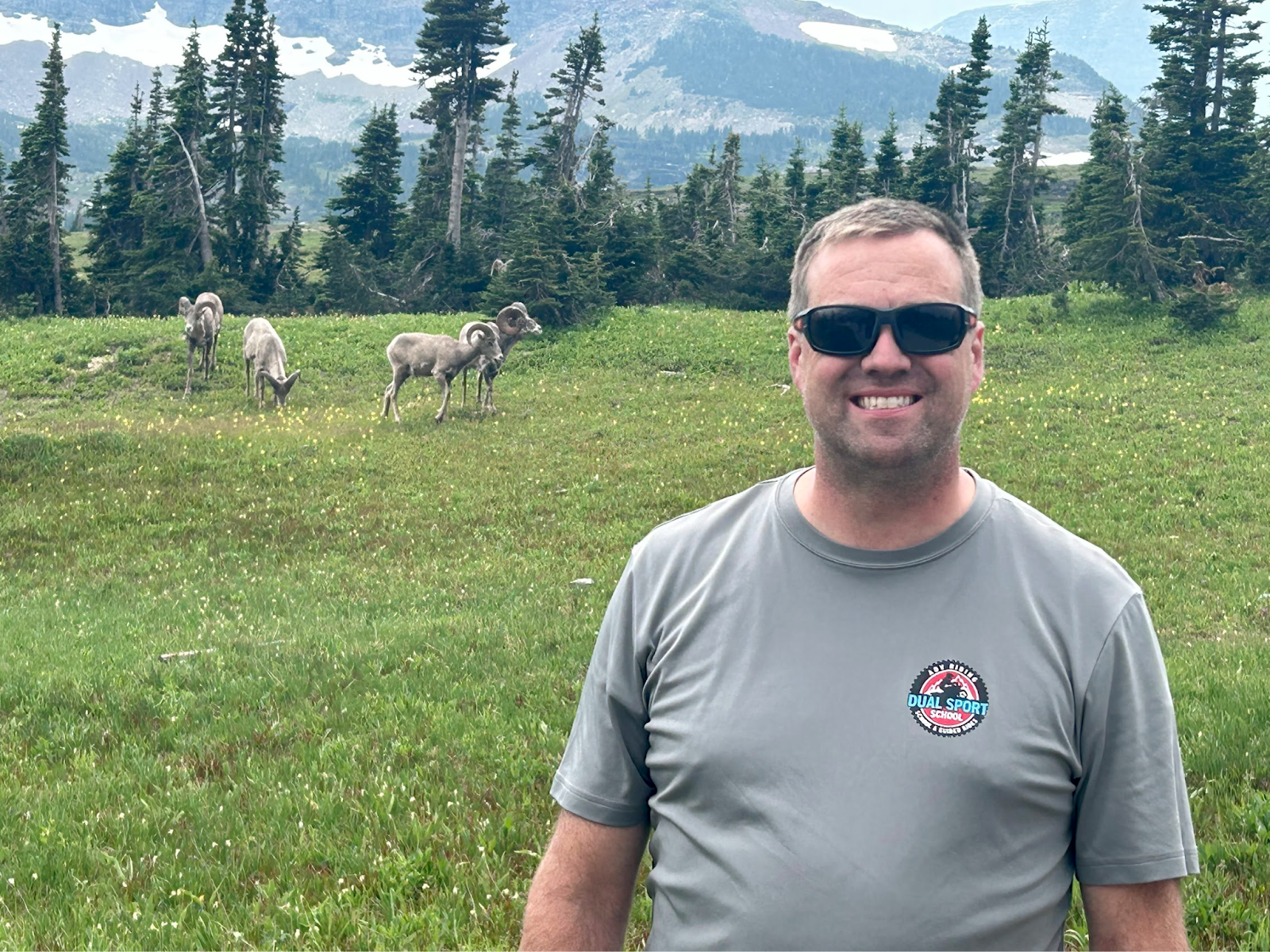
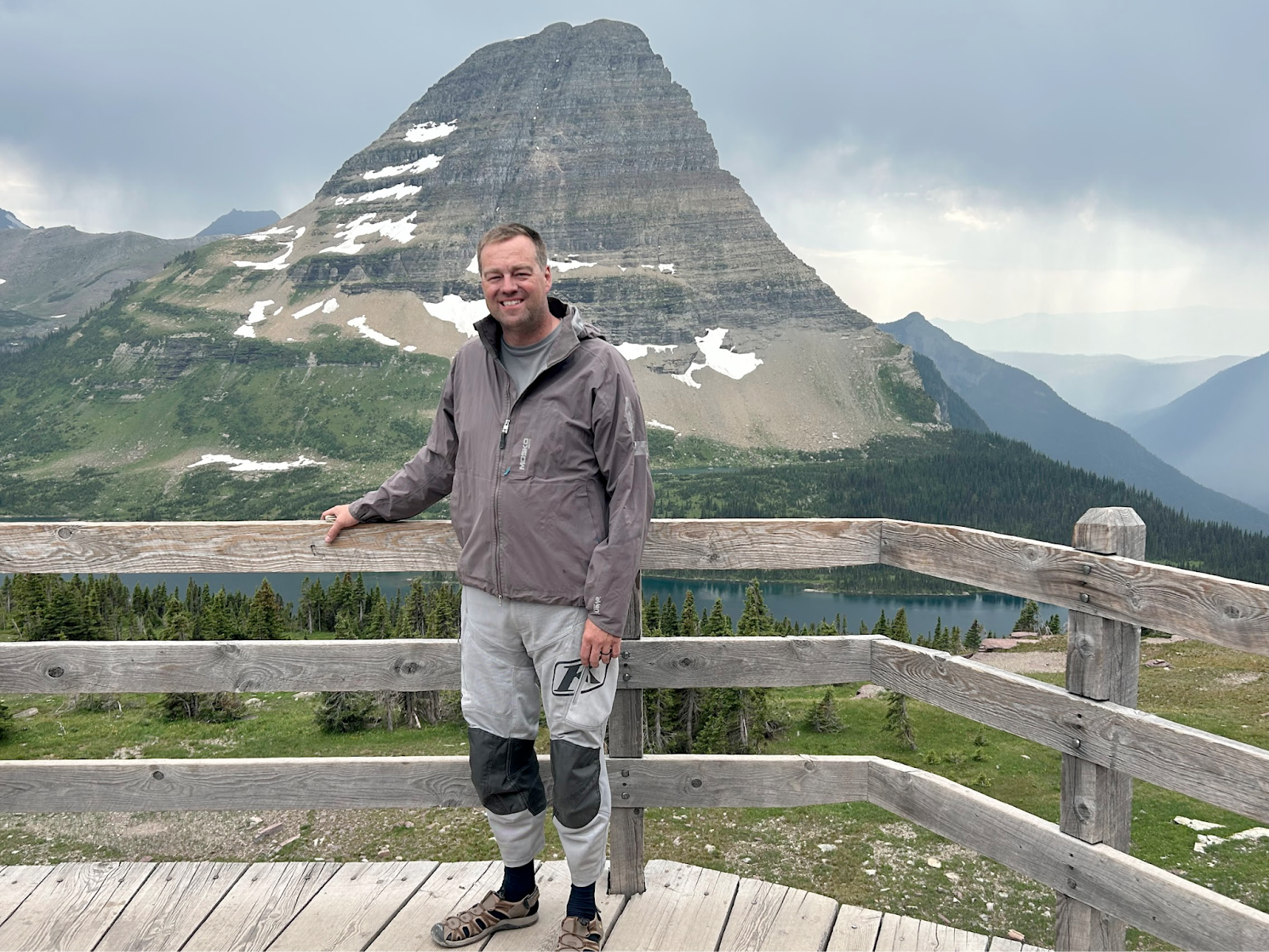
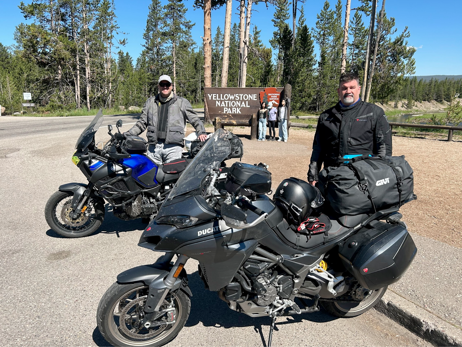
DAY3(Friday): Left blue bay and headed to Glacier national park > had trouble getting into the park w/o a vehicle pass. Went around on HWY 2 and came in east side of park > went up to Logan Pass. Hiked up to Hidden lake and got very close to big horn sheep and mountain goats. Saw a grizzly bear at 800 yards. Went down highway to the sun and headed for Canadian border up HWY 93.
Camped at a wild camping spot recommended by Ioverlander APP.
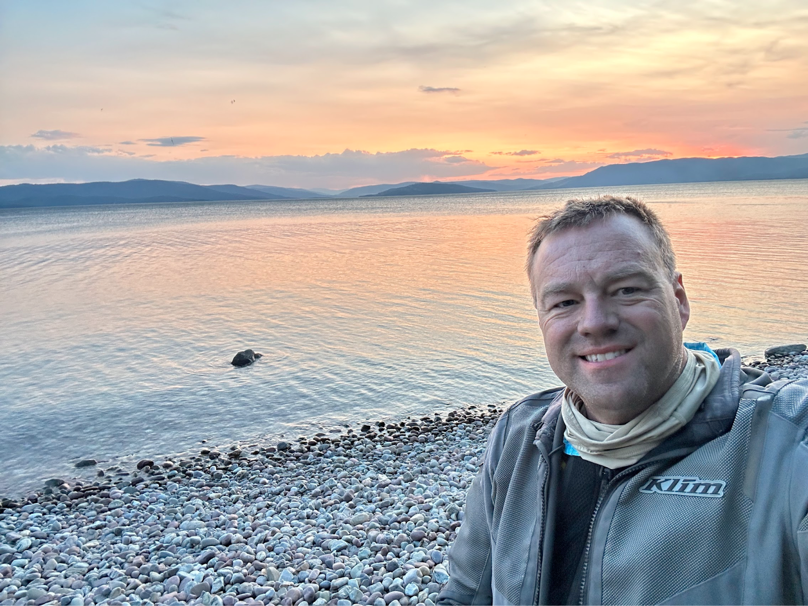
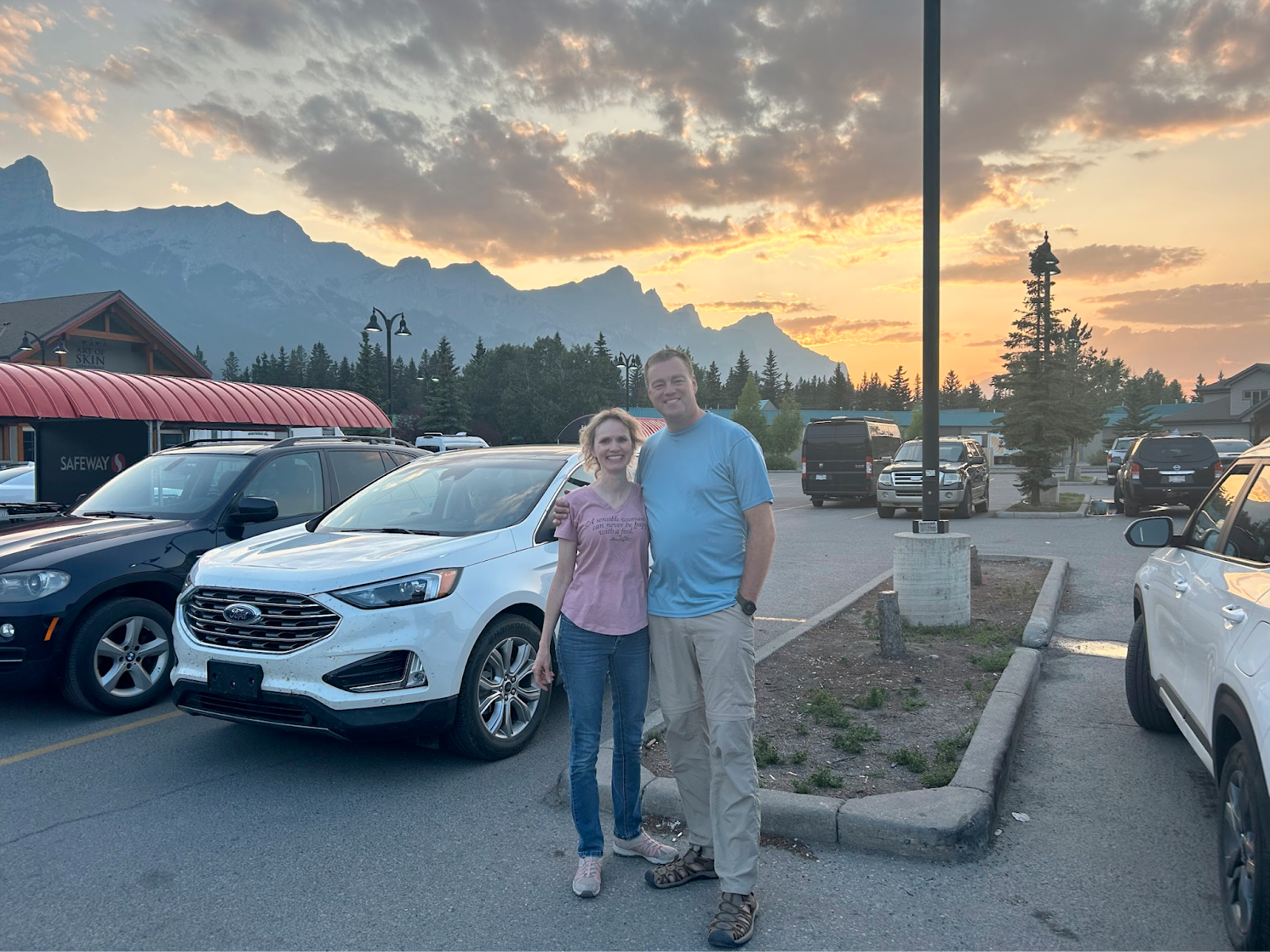
DAY4(Sat): Headed to Calgary to pickup rental car before they closed at noon. Very very cold and we finally stopped and put on my wind blocking clothes. Steve went 30 miles with running out of gas light on. At calgary, I Noticed front tire was cupping, so I got a new front tire at jacks power sports for about $280 USD while we eat at Dennys. Then we headed to Deadman's flats CAN where the condo/airBNB was. Saw an awesome sunset while getting groceries and swung by A&W for a late snack and went to condo.
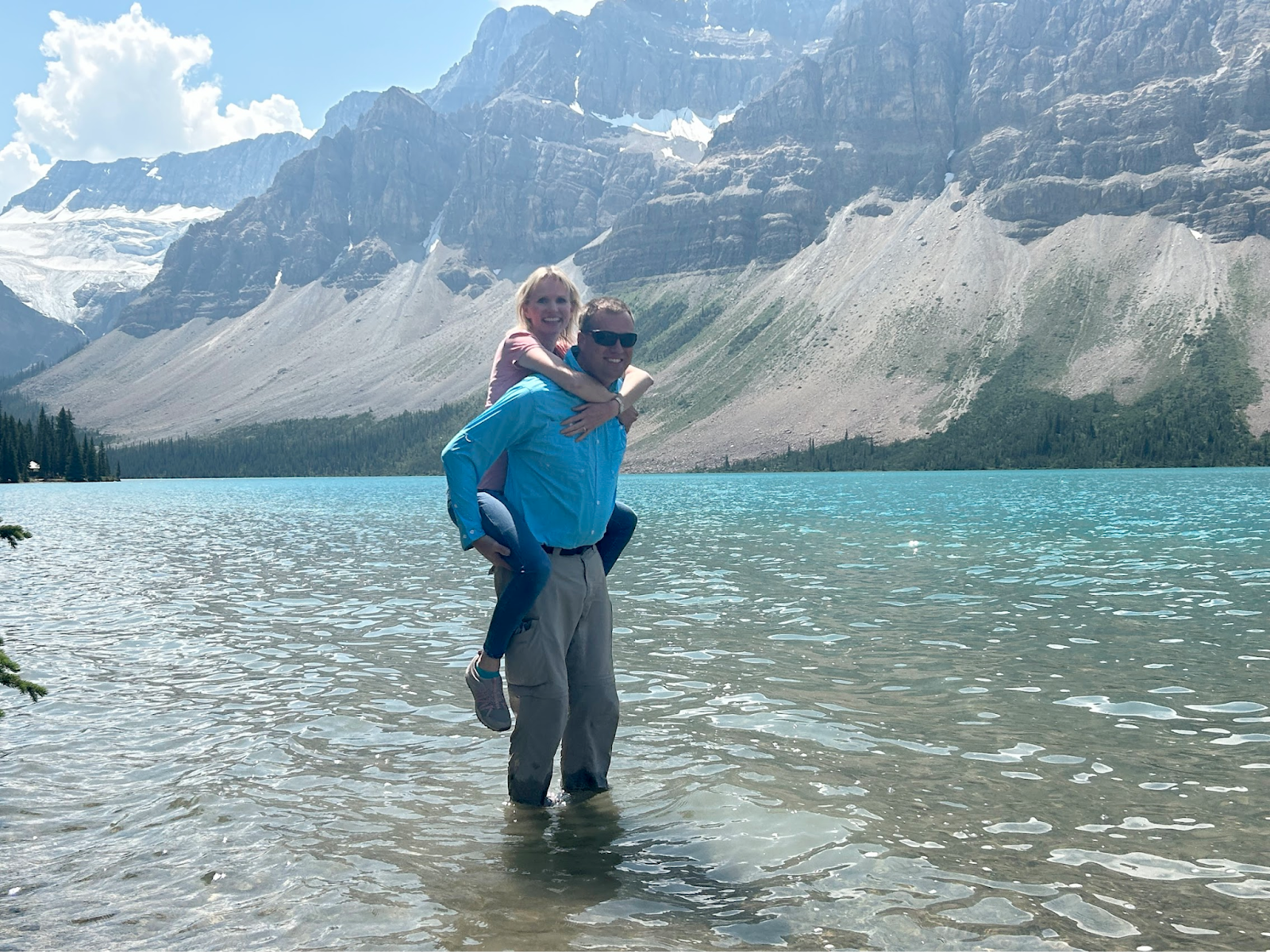
DAY5 (Sunday): took rental car and our wives to Banff. Found Lake Louise required a special pass, or wait until after 7pm. So we explored the rest of banff and got gift shop items, photos etc along the way. We packed a pre-made sandwich and eat it at “bow lake”. On the way back we got super lucky to find a parking spot at Lake Louise. Karen suggested 3 options for day6. The girls wanted to go shopping and Steve and I wanted to take our bikes to Jasper.
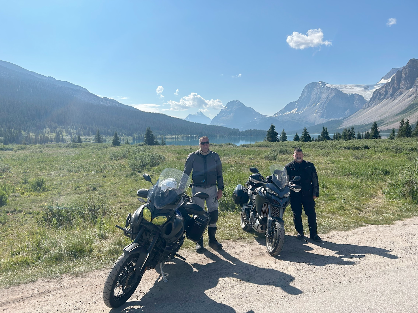
DAY6(monday): By moving up our bike ride through Banff/Jasper, we hoped to be able to hit Beartooth Pass. So day6, we headed out about 7am and got lots of gopro and photos along the way. We saw a 1 year old Black bear about 30 feet away at the tree line and then later saw a larger blackbear on the sideo f the road, I road my bike within about 10 feet of him and asked if he wanted to race my bike ;)
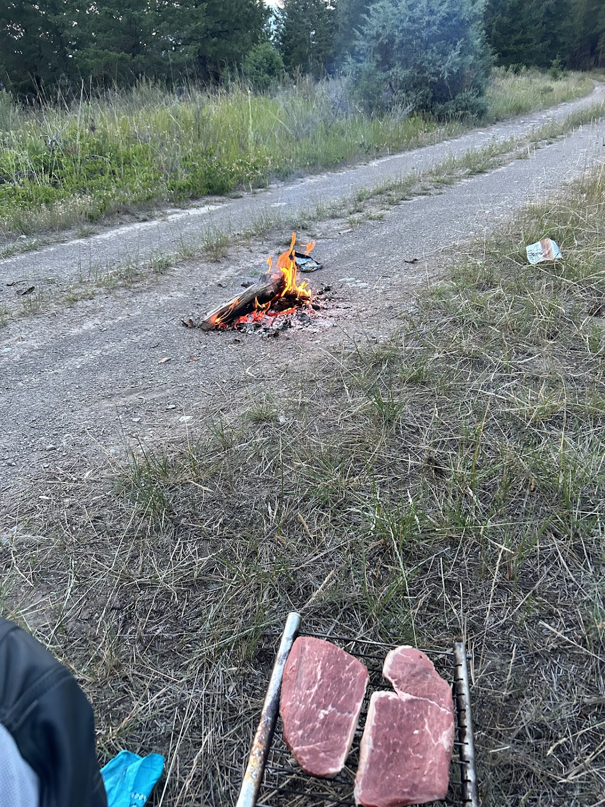
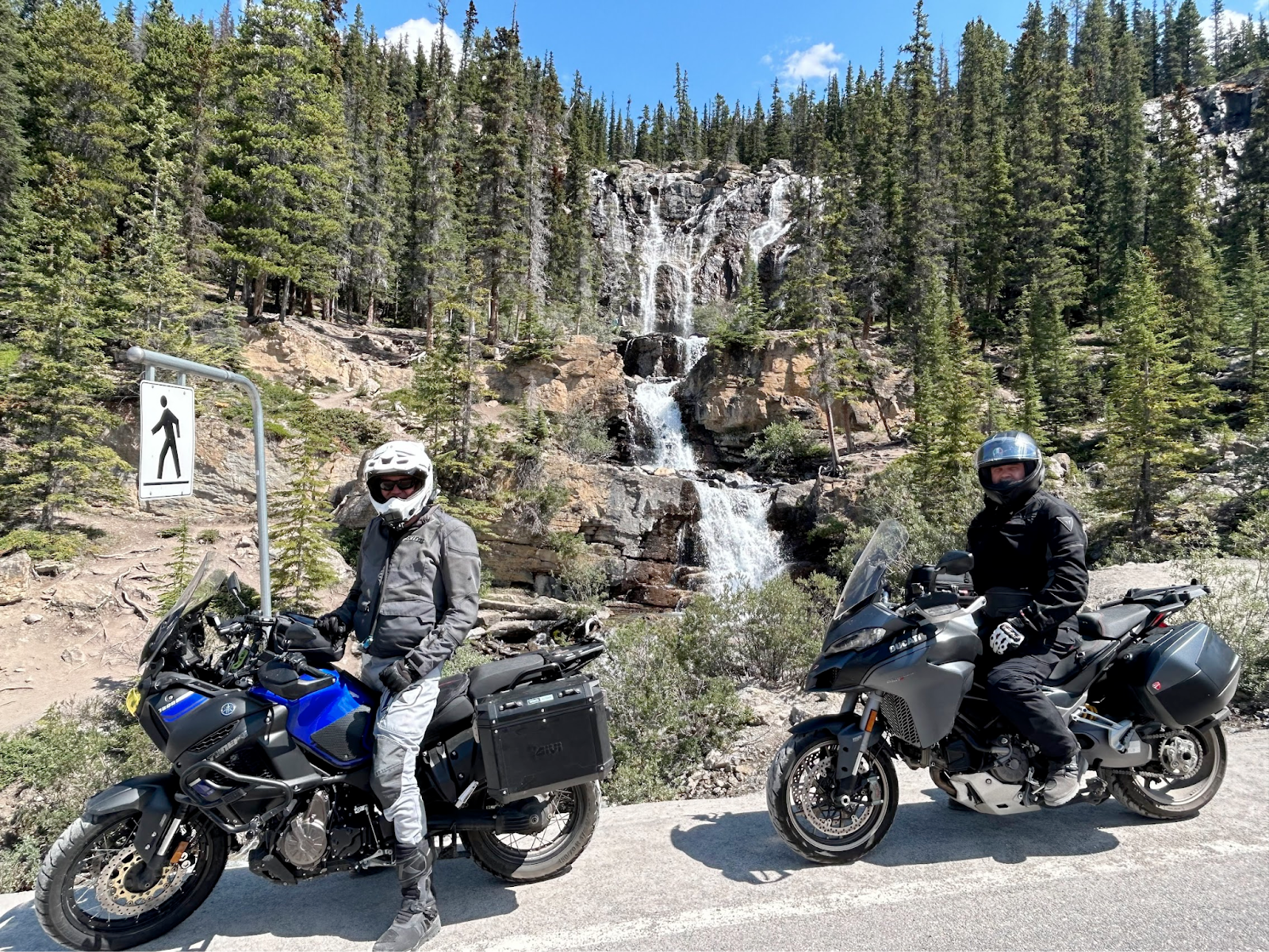
We had lunch at cool water fall. With my improvised cooler and left over premade sandwiches.
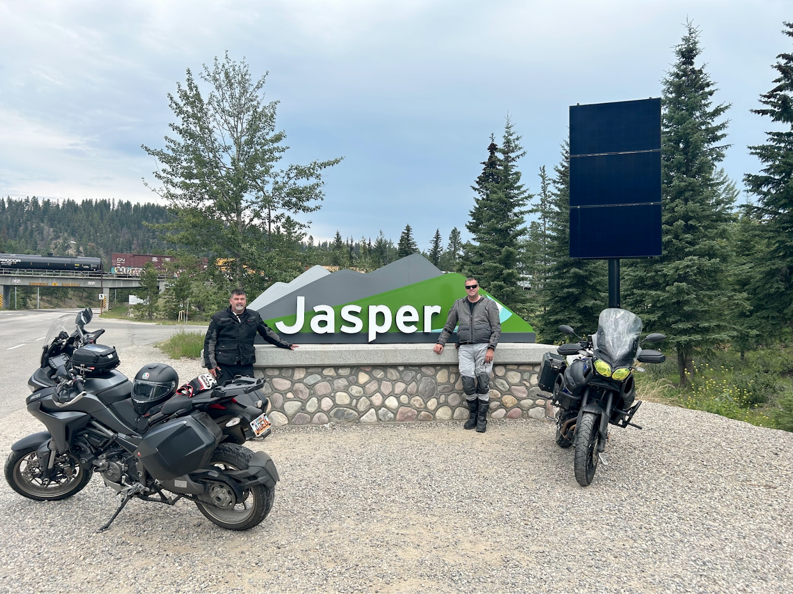
We got to jasper about 2:30pm and a long long ride back.
Near the ice fields we caught up to a BMW 1200 with a Utah plates. We all pulled over and talked. Richard had solo’d to Prudo Bay and most of alaska/canada. We got more photos at ice fields.
We got back to deadmans and took the girls to a fancy/expensive dinner.
IMO the Peyto Lake overlook is the most beautiful place I’ve ever seen!
DAY7 (Tues): left condo about 7am, girls took rental car and Steve and I road to the rental car place. Steve took the girls to the airport in the car and I watched his Ducati and organized my stuff and planned out routes. Most mornings I had plenty of time to go for a walk, plan routes and pack up before Steve got up. We then b-lined down and got into a rain storm over and over again, we finally got in front of the storm and crossed the border CARWAY > stayed on HWY 89 through browning > bumped into Richard again, I caught up to him as we were taking a break from the high winds. We invited Richard to dinner in Great Falls and found a cool restaurant. > Steve invited him to our Hotel and he showered and fell asleep on his air mattress.
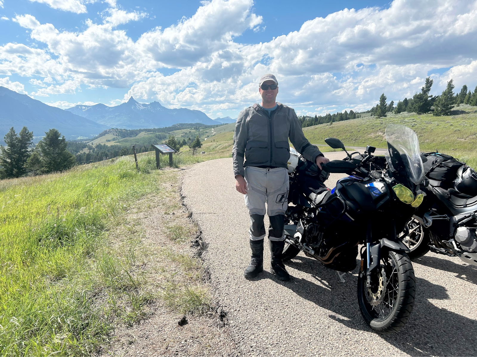
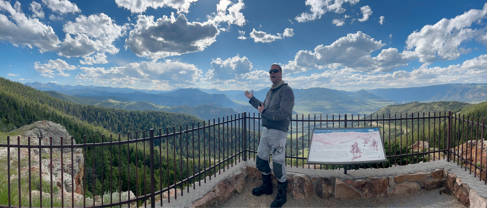
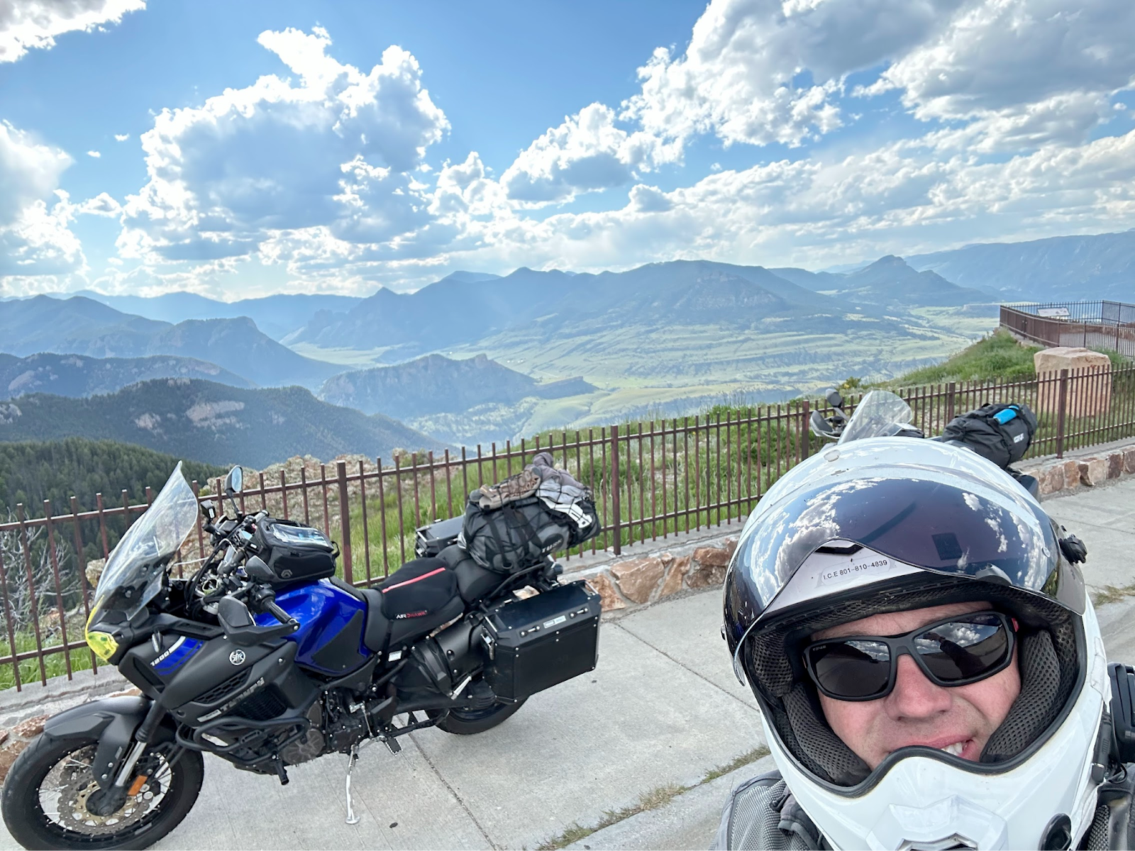
DAY8 (Wed). Richard stuck with us until White Sulfur, headed east on HWY 87 from great falls > hwy 89 to Clyde Park and then I90 east to Big Timber for lunch > headed east to Columbus > went to fish tail to Redlodge. Got some snacks and drinks in redlodge and headed up Beartooth Pass and then hit Chief Joseph HWY and got to Cody WYO and found a Gov RV park that charged $30 per bike. Really pretty bluffs, but too many mosquitoes IMO.
DAY9 Thur).
We left early and went into yellow stone and went south to tetons. Stopped for a Bison Burger.
LOTS of photos along the way! We took the back way to Teton Village to Wilson and lots of cool farm lands. It was GETTING HOT. Got gas and got wet in Wilson and headed through Swan Valley to Rigby to visit KLIM, then headed to rexburn to See my daughter and take my son-in-law and daughter to dinner. We had a nice visit and slep on their floor with our air mattresses.
Day 10 Friday: From rexburn via I15 to HOME. I did a run-out of gas test, but was going close to 85-90 most of the way and only got 250 miles before running out of gas.
I loved this ride/trip, so good to have a break and see my wife about half way through!
I love going North in the summer and finding cold spots in the morning and getting wet and riding wet in the hot parts of the day.
GEAR REVIEW:
T1200 did awesome! At almost 600 lbs its really a great long range bike! I loved the mesh klim baja S4 jacket with a klim wind blocker thin long sleeve jacket, only a couple of time I needed m winter gloves.
Protip: put rain pants/jacket it on before a big downpour! We got soaked for 45 min coming back tot he condo from Jasper. If we didn’t have a warm condo go to to dry off, we would have had a miserable time in a tent.
My ruggedized android phone worked great! I did need to pre-download google maps in Canada cuz my usmobile cell service didn’t work. Steve’s garmin wouldn’t charge after a few days of riding, lost power somehow (fuse or wire).yk
DATE: July 5-14th, 2023
SCREENSHOT OF ROUTE:
LINK TO ROUTE:
LINK TO VIDEO:
SCREENSHOTS:
FAV PHOTOS:
https://photos.app.goo.gl/cFRWyZNoqPoD5p9Z8
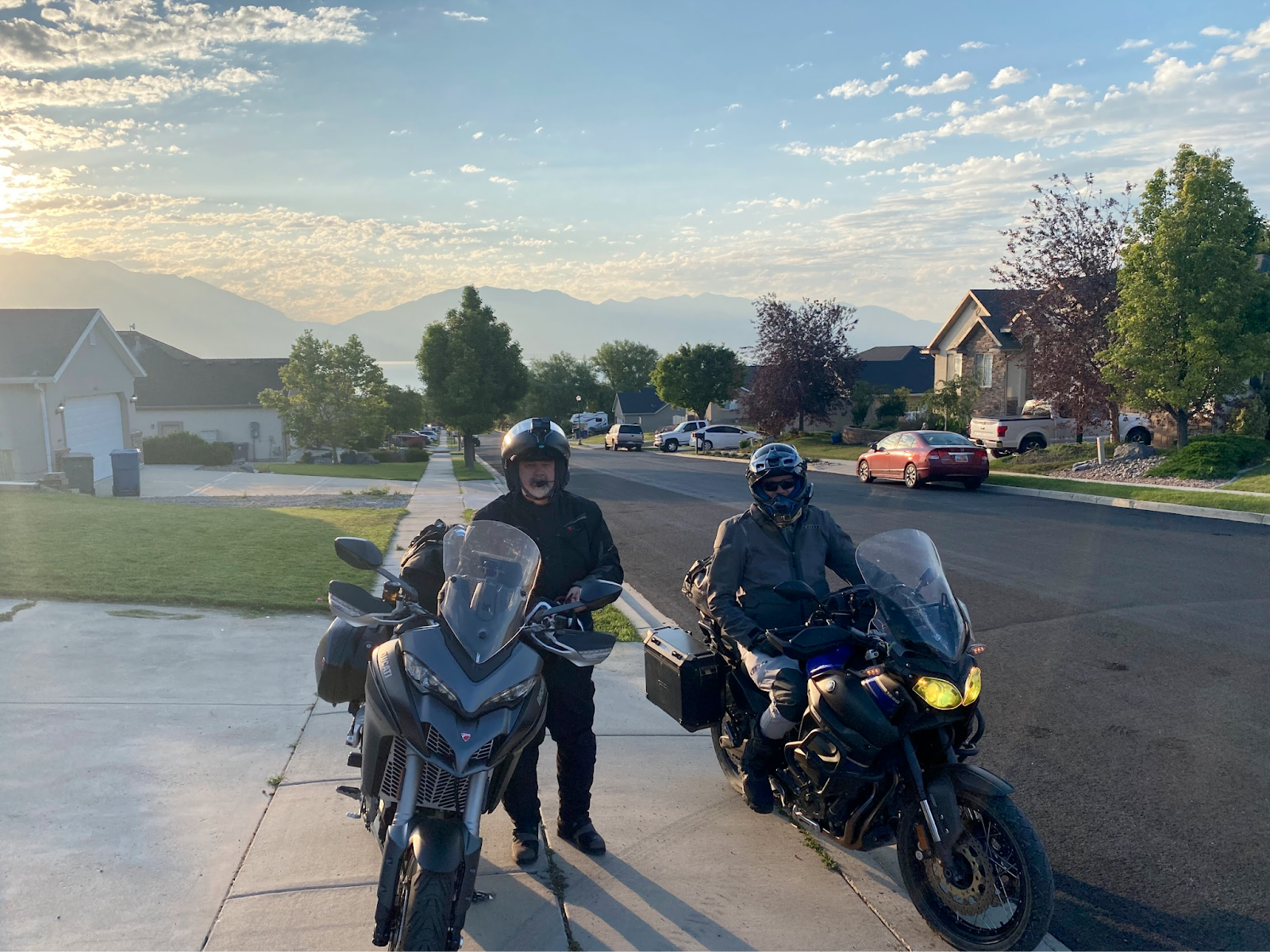
DAY1 launch photo:
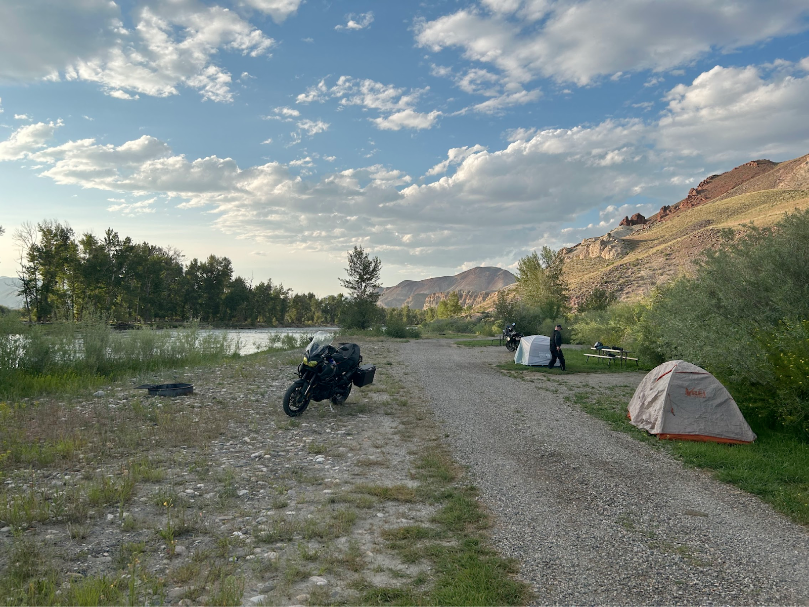
Day1 campsite:
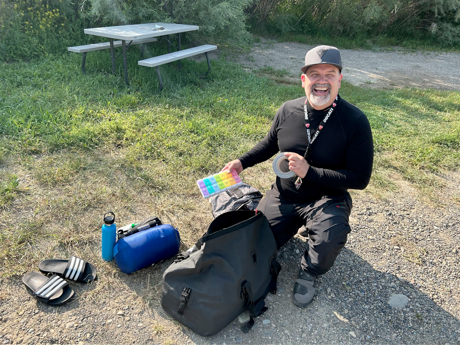
Proof someone packs more stuff than me >
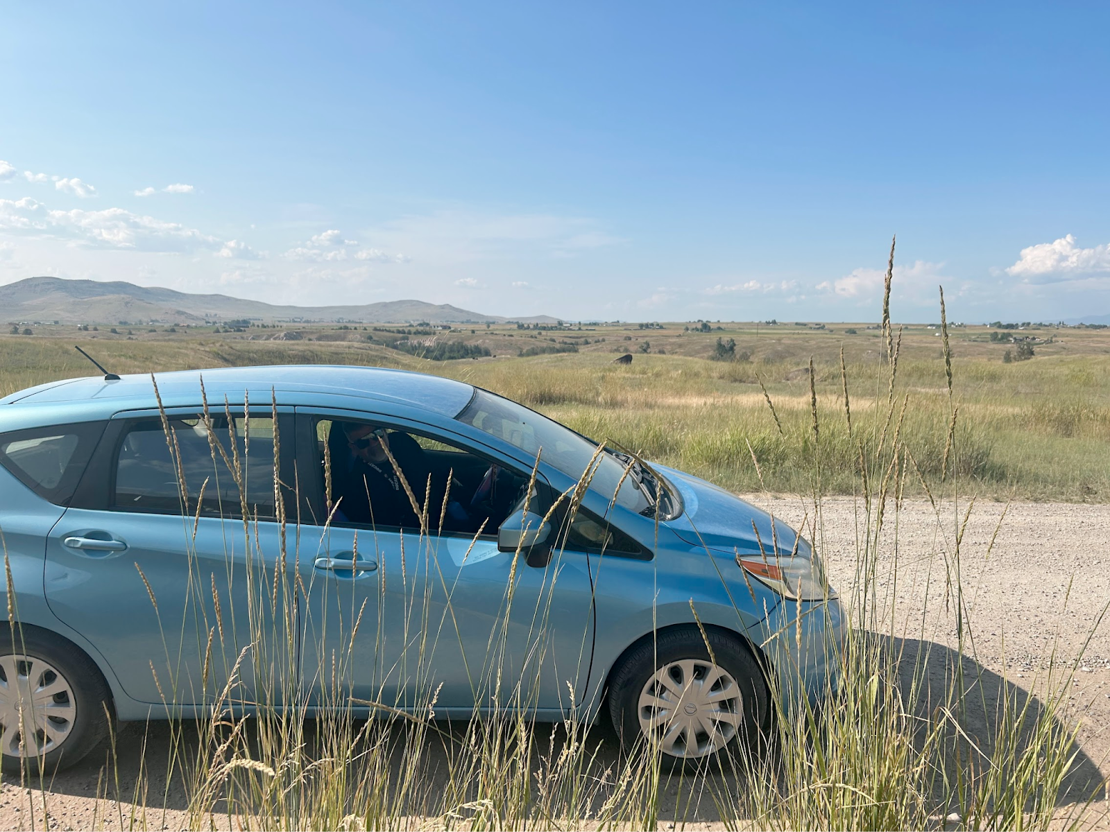
Motorcycles are not allowed on bison range, so gift shop Lady lent us her car >
Cold bath in flathead lake >
Future riders >

West of Cody WYO:
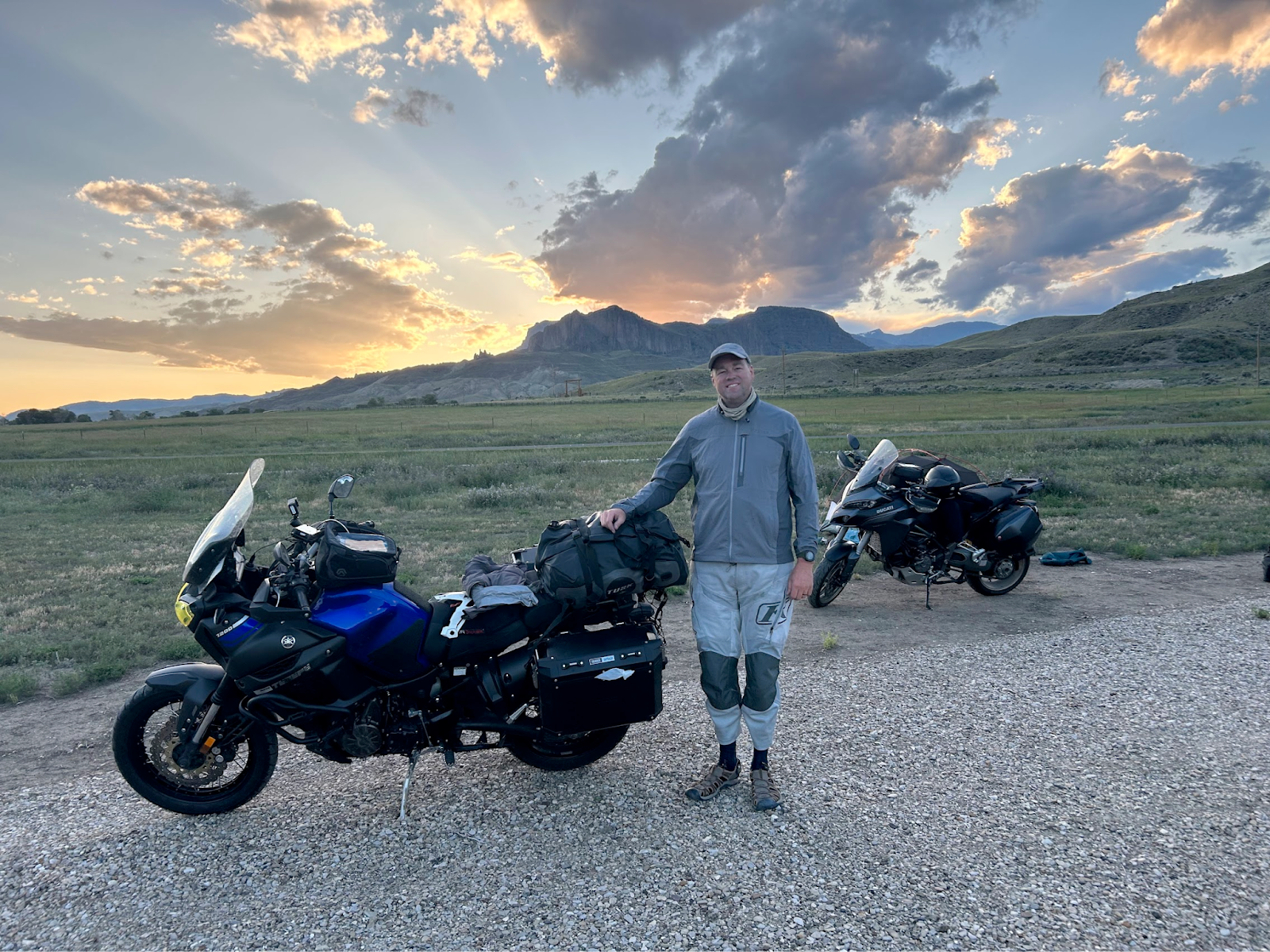
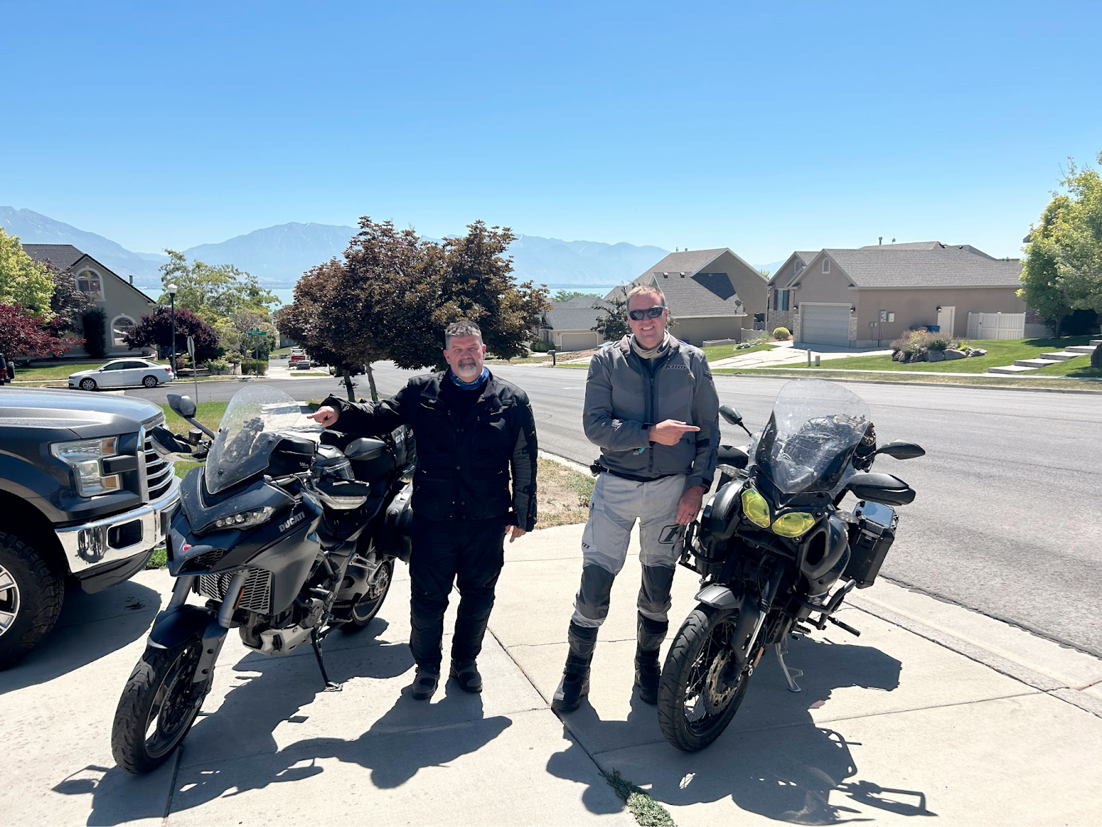
ENDING photo, with 4000 bugs on our bikes!
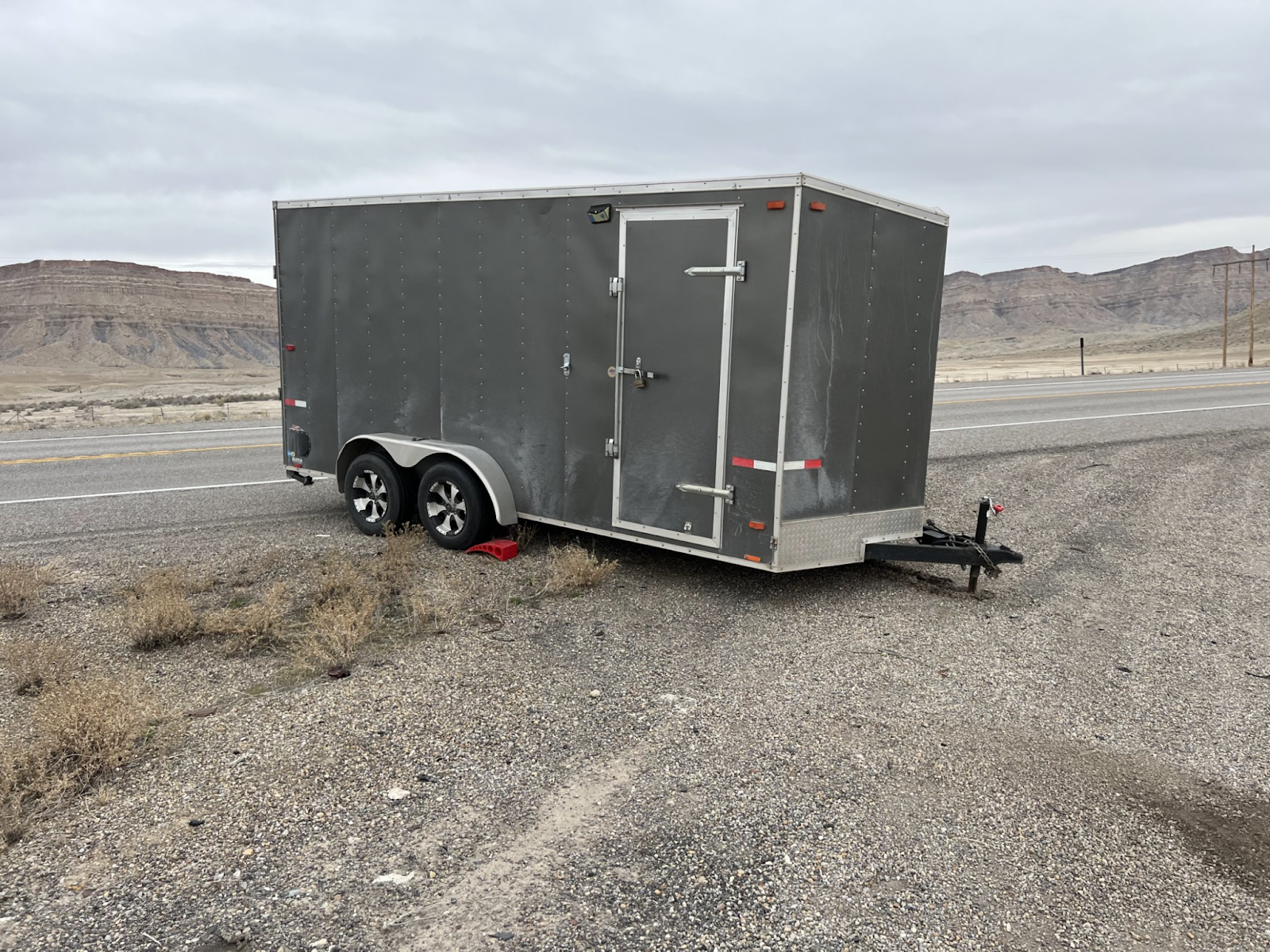
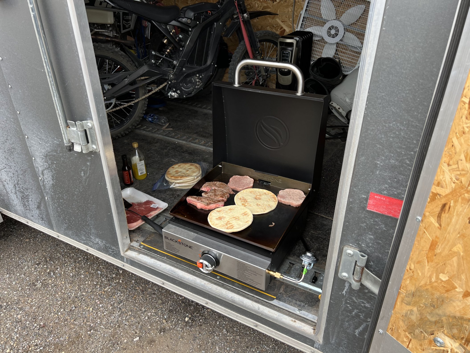
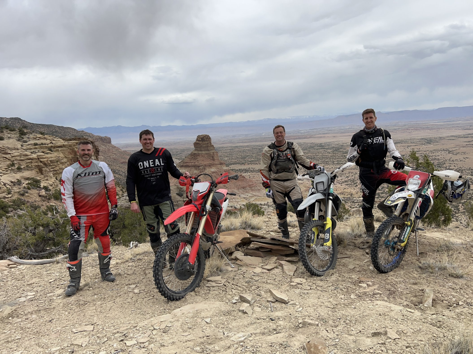
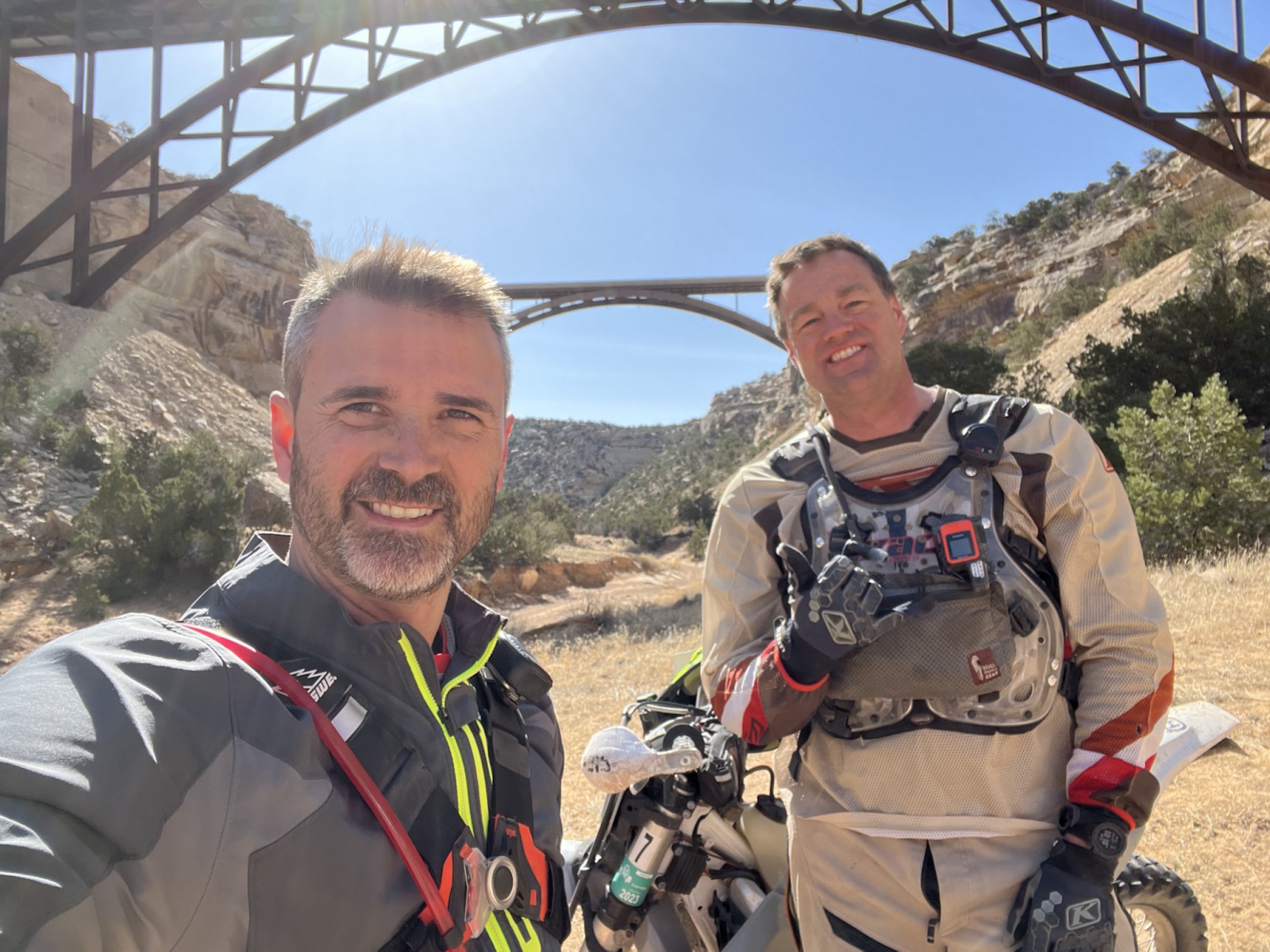
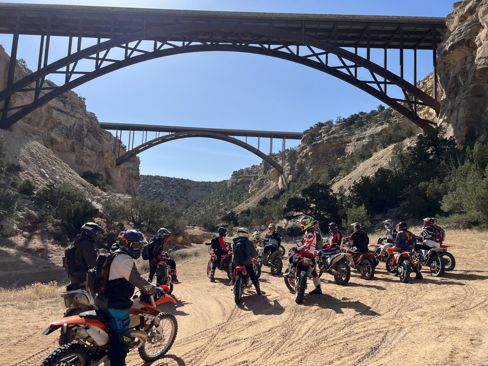
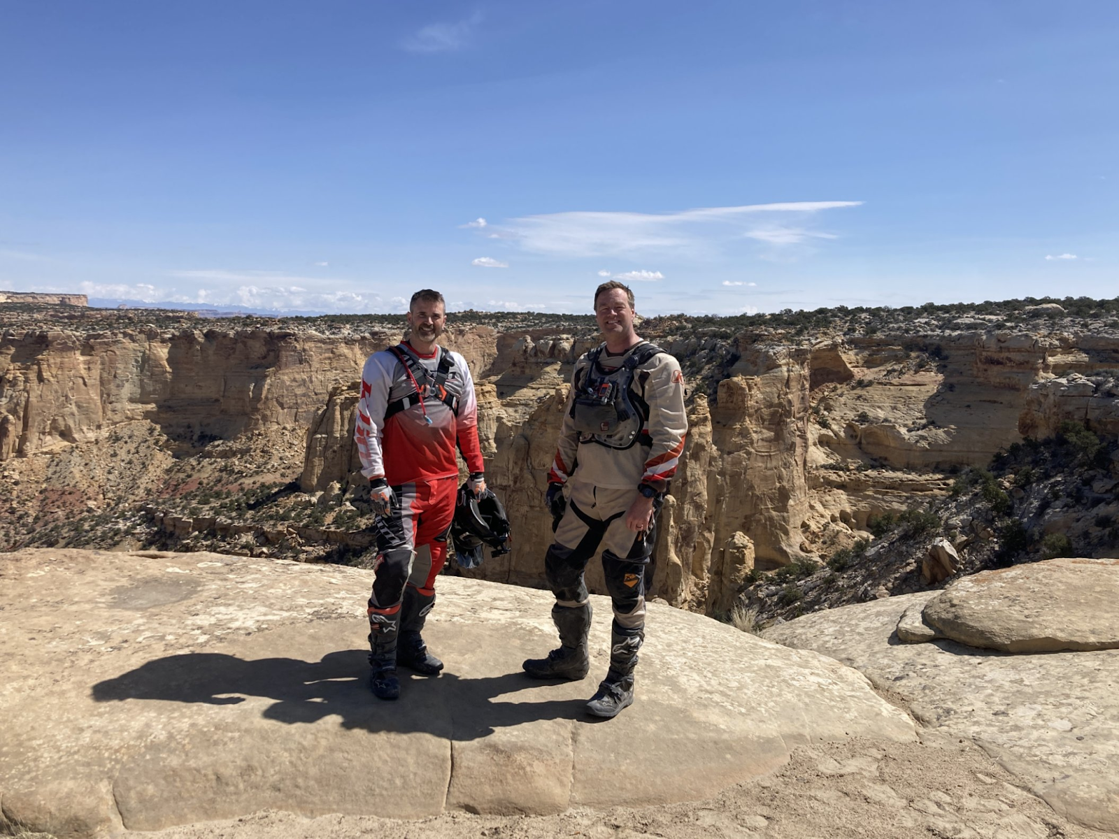
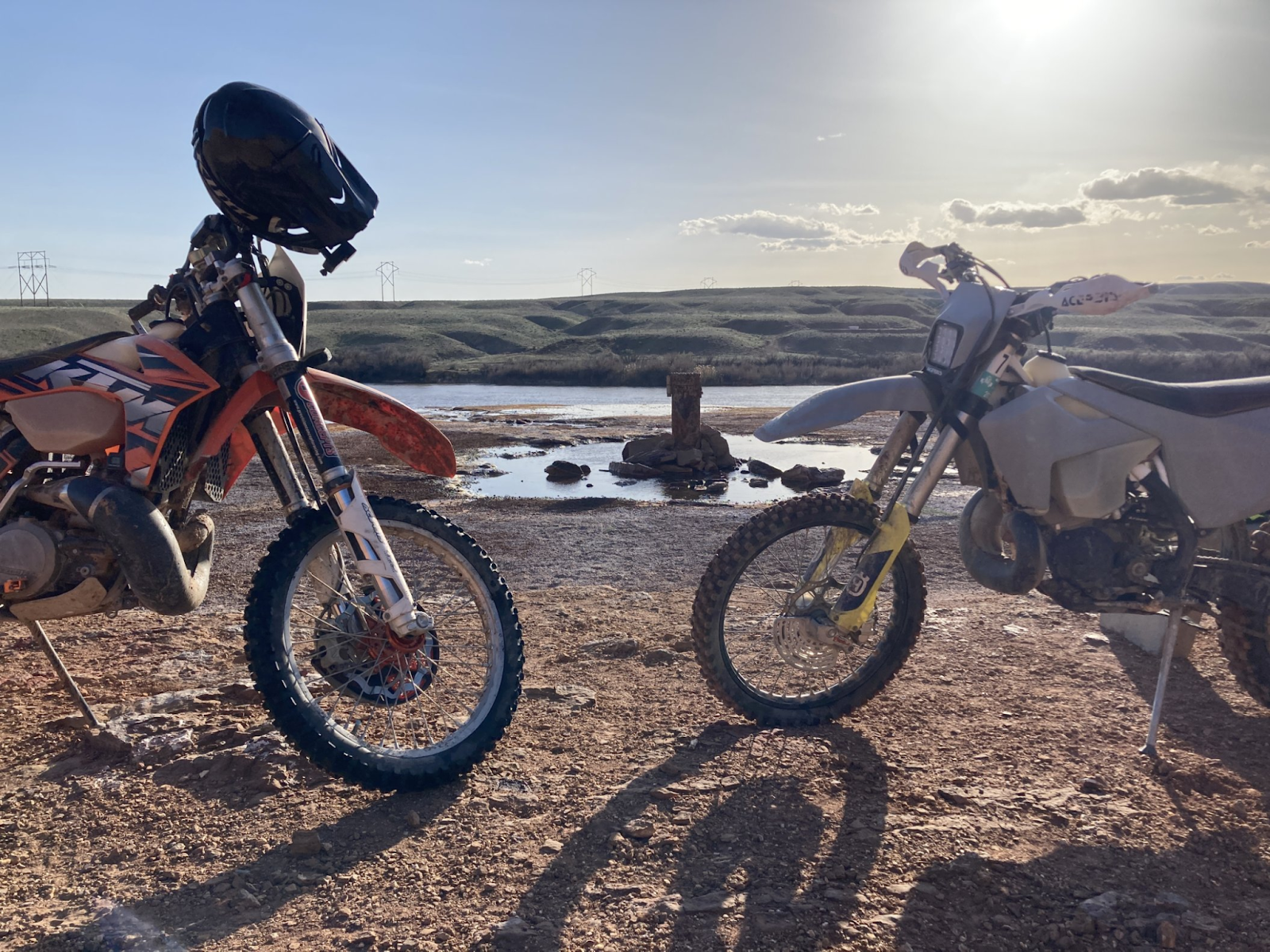
ROUTE DESC: Green River Dirt Bike Rally
RECAP/SUMMARY/Ride Reflections: Good to meet new/old friends, but 3 days of riding back to back is a bit much on my old body given we did 50 miles per day and about 5 hours with a mix of rough double track and single track. I would rather go do a very hard trail for 3 hours like “red trail”, then 5 hours of doubletrack.
I liked getting a good deal on Thumper Jockey moto lights. I got two helmet and one 3000 lums kit for my T7.
I also LOVED the gpx file provided to the rally attendees. This was worth the $40, shows skill level trails and all in one folder for gia gps.
I gave the tshirt to my kid (got his size). The paper maps were cool and lent those to my neighbor.
Rich Larson not coming was a major let down. We’ll have to hire him to coach us before we do 5 miles of hell.
LEVEL: 1 noob on a small ish bike. Level2: skilled rider on smallish bike. Level 3: extremely difficult trail from an experienced riders perspective.Needing buddies in case things go wrong and to help get through challenges.
FLOW TEST is a very simple dirt bike, dual sport, and ADV trail ranking system, which measures the following criteria on a scale of 0 to 5, 5 being the most difficult:
F - Fatigue (5=hard enduro like erzberg)
L - Length (time)
O - Obstacles (5% of riders can do 5 level)
W - Width (0=blacktop 1= dirt road where two cars can pass, 3=dual track, 5=width of dirtbike tire)
Two scores - common and highest
T - Traction (5=extremely slick mud)
E - Exposure (Cliffs 5=a mistake is certain death)
S - Steepness (1 point per 10% degrees -- 30 degrees=3)
T - Technical Terrain (opposite of flowing trail-- erzberg challenges would be 4, some pieces 5)
All points CAN be summed up.
RATING THIS TRAIL: 2-3
DATE: April 14-15, 2023
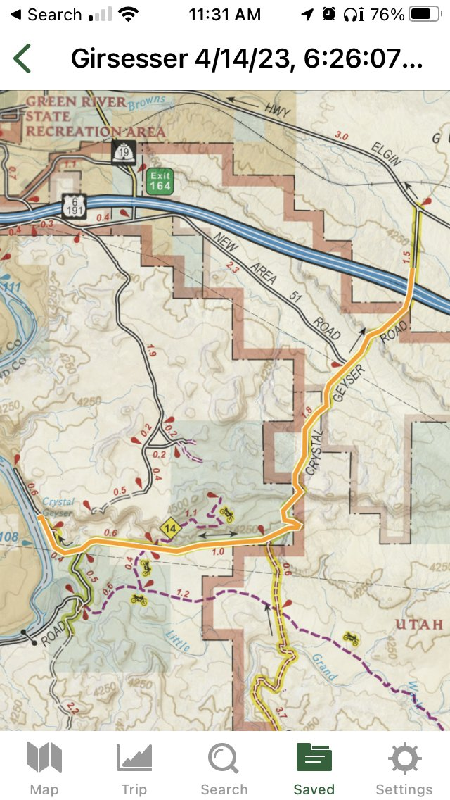
SCREENSHOT OF ROUTE:
Thursday:
Friday:
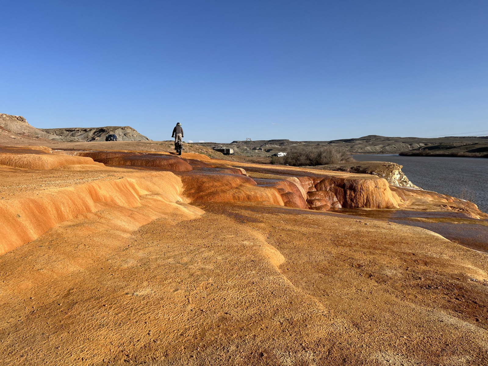
Crystal Geyser, kind of lame, but we had time to burn and too tired to ride anywhere else.
Saturday:
LINK TO ROUTE:
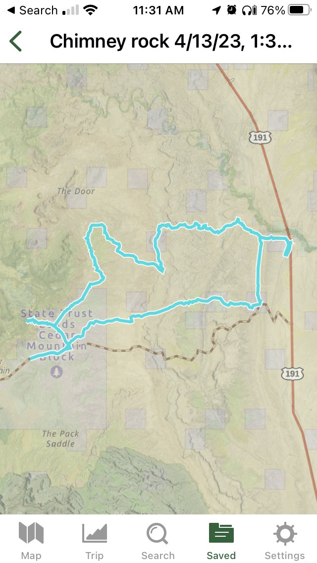
Chimney rock:
https://www.gaiagps.com/public/D6wFtinrHWfzE64Yg2RQM4BS
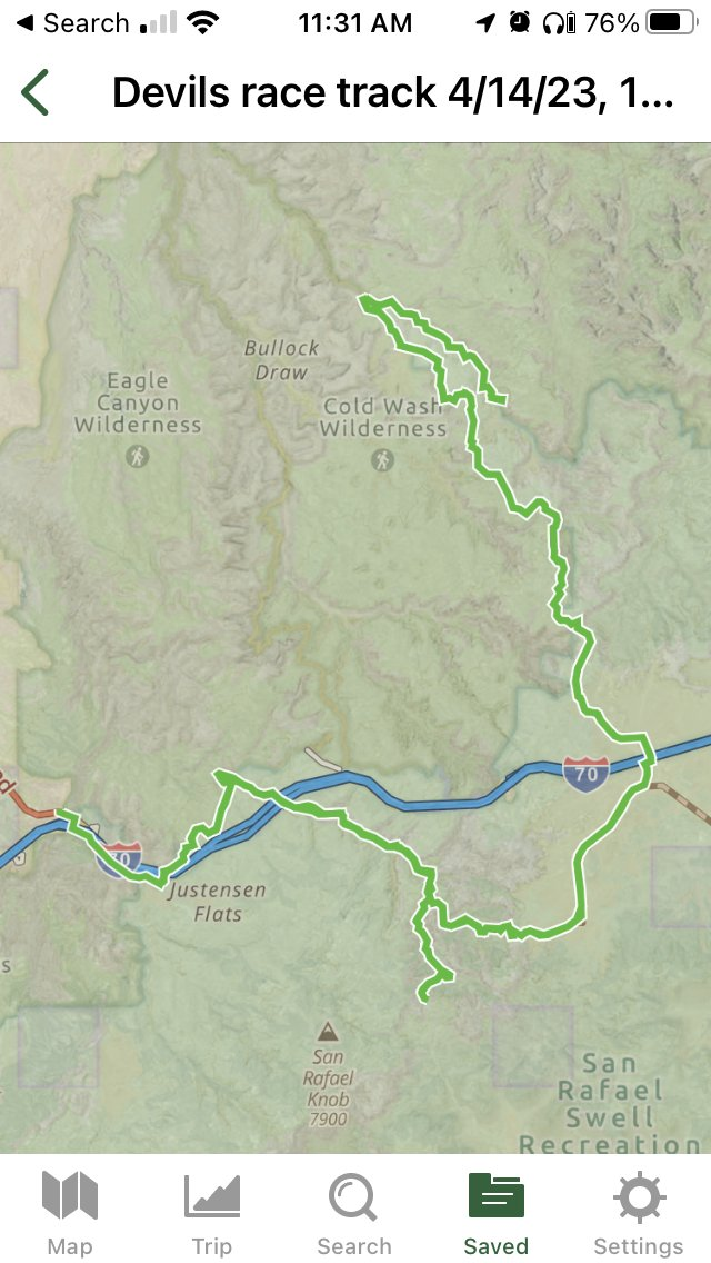
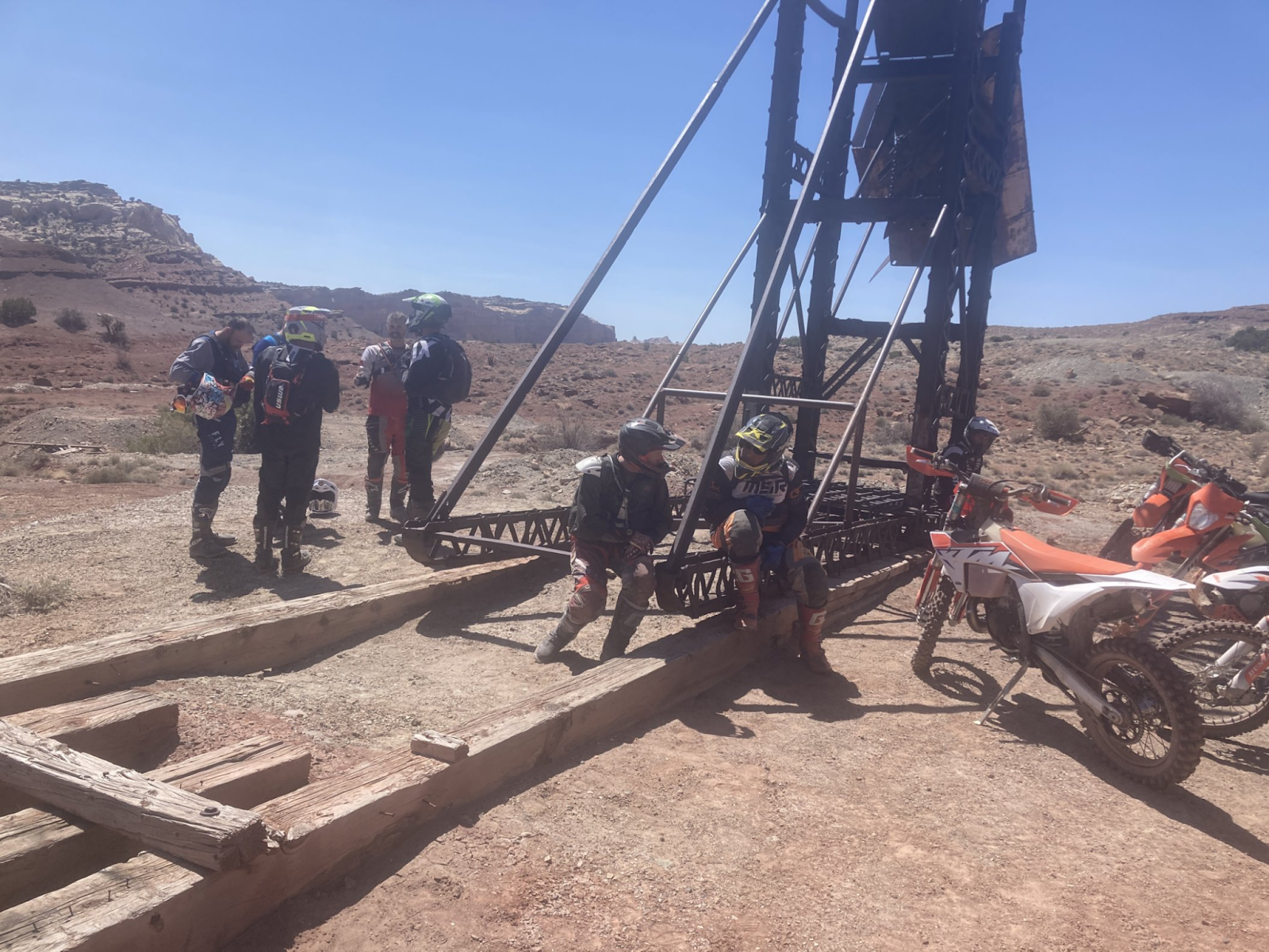
Devil’s Racetrack:
https://www.gaiagps.com/public/912tZRXSPxwiVvB8XnJq2Rgb
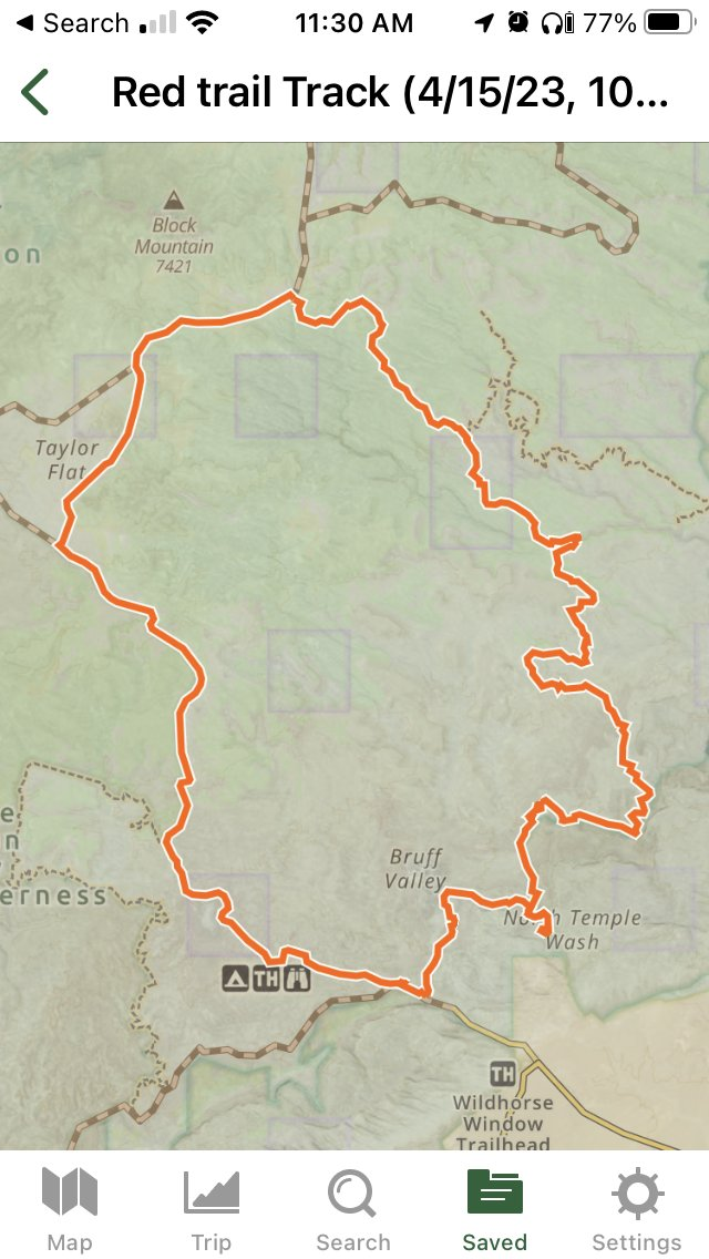
Red Trail (colored trails):
https://www.gaiagps.com/public/OUKwN3Qrxur1zAJpaNAiJCvy
LINK TO VIDEO:
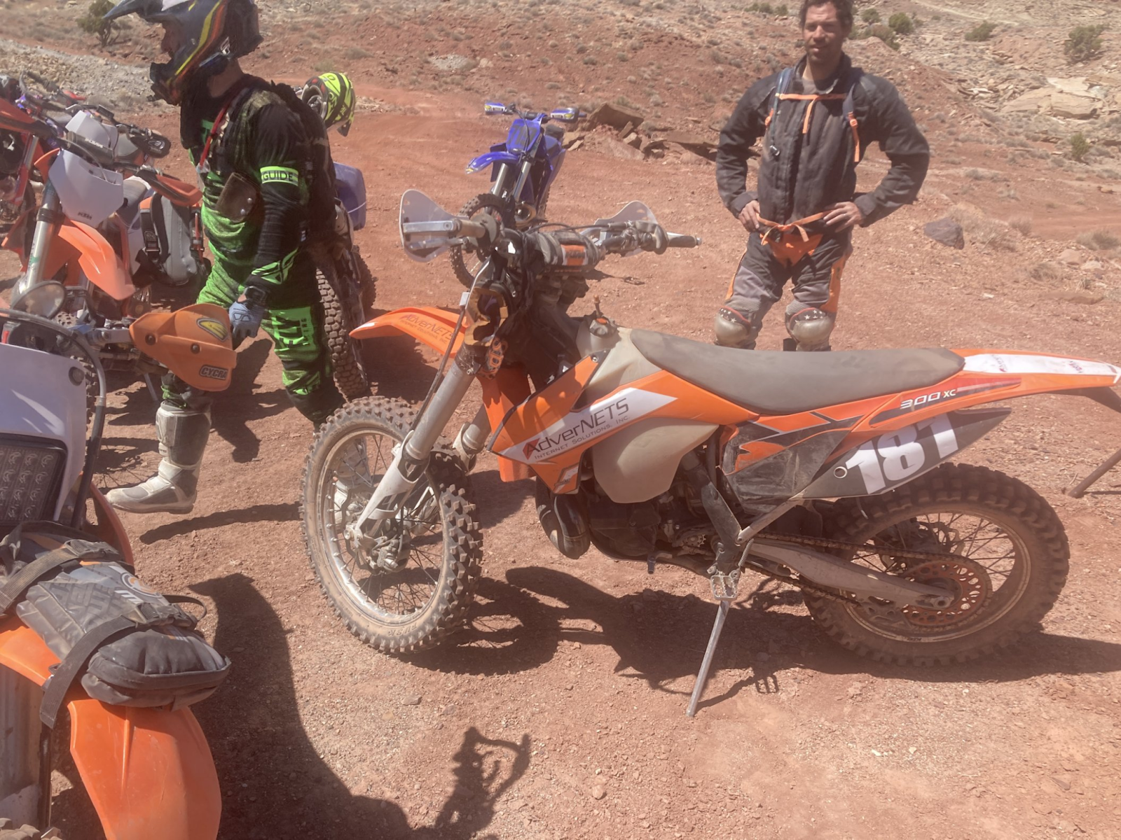
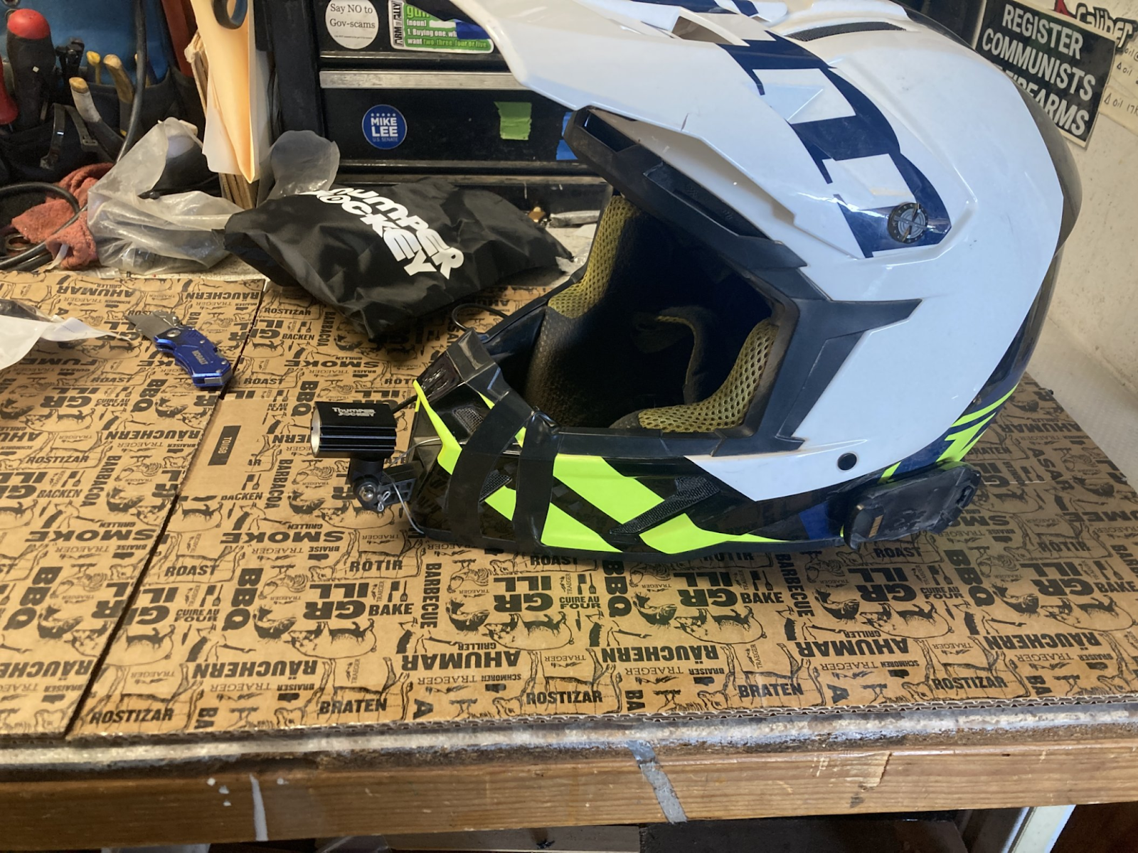
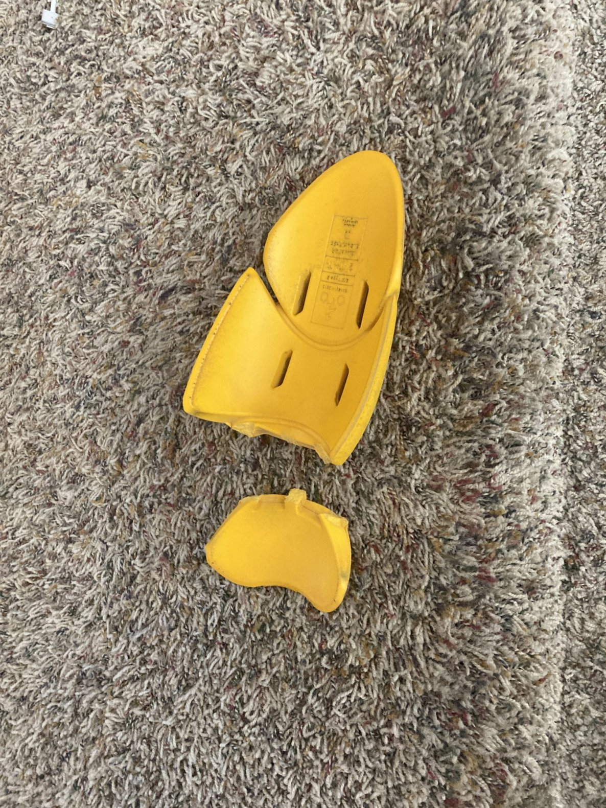
SCREENSHOTS:
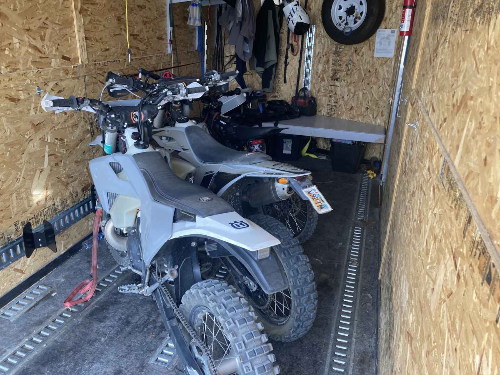
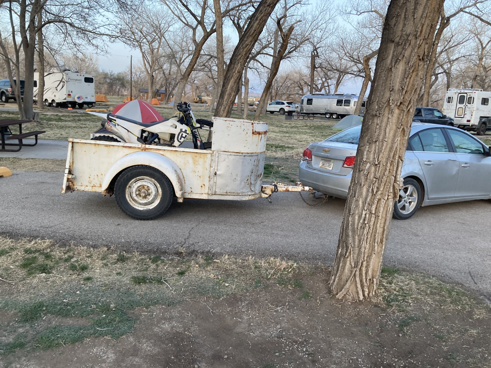
Two spare bikes:
Motorhome got stuck, cuz too long and pinched jack into gravel:

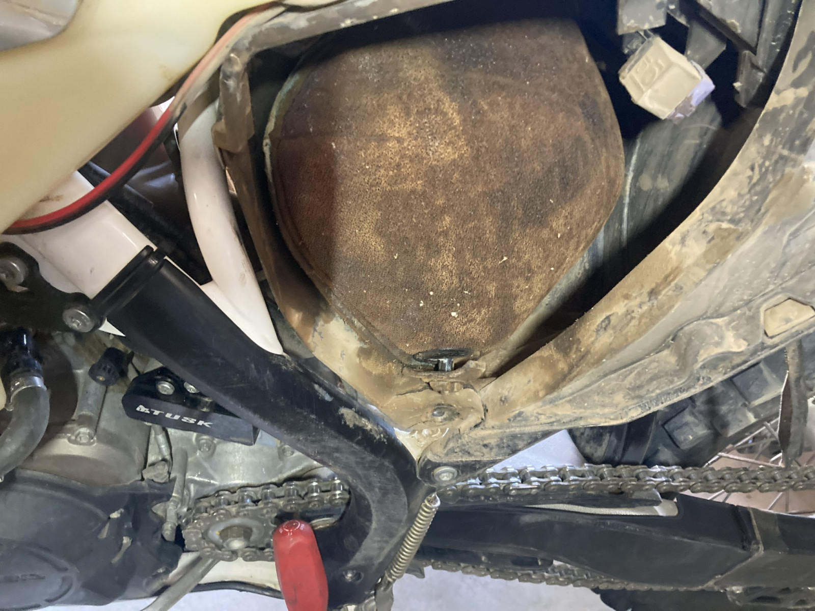
DUSTY!
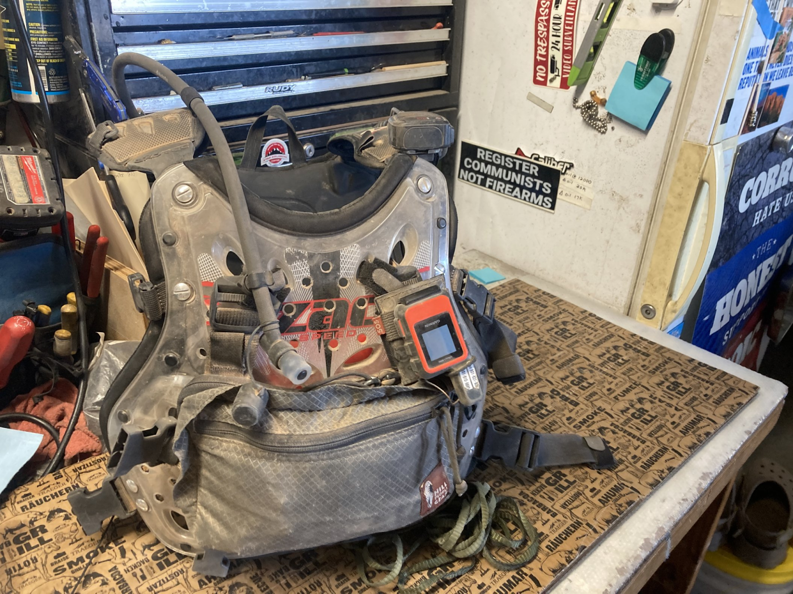
Air filter:
Helmet light:
Broken elbow pad:
GEAR REVIEW:
RECAP/SUMMARY/Ride Reflections:
LEVEL: 1 noob on a small ish bike. Level2: skilled rider on smallish bike. Level 3: extremely difficult trail from an experienced riders perspective.Needing buddies in case things go wrong and to help get through challenges.
FLOW TEST is a very simple dirt bike, dual sport, and ADV trail ranking system, which measures the following criteria on a scale of 0 to 5, 5 being the most difficult:
F - Fatigue (5=hard enduro like erzberg)
L - Length (time)
O - Obstacles (5% of riders can do 5 level)
W - Width (0=blacktop 1= dirt road where two cars can pass, 3=dual track, 5=width of dirtbike tire)
Two scores - common and highest
T - Traction (5=extremely slick mud)
E - Exposure (Cliffs 5=a mistake is certain death)
S - Steepness (1 point per 10% degrees -- 30 degrees=3)
T - Technical Terrain (opposite of flowing trail-- erzberg challenges would be 4, some pieces 5)
All points CAN be summed up.
RATING THIS TRAIL: xyz
DATE:
SCREENSHOT OF ROUTE:
LINK TO ROUTE:
LINK TO VIDEO:
SCREENSHOTS:
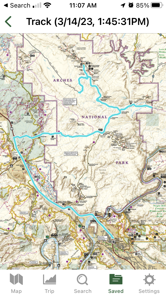
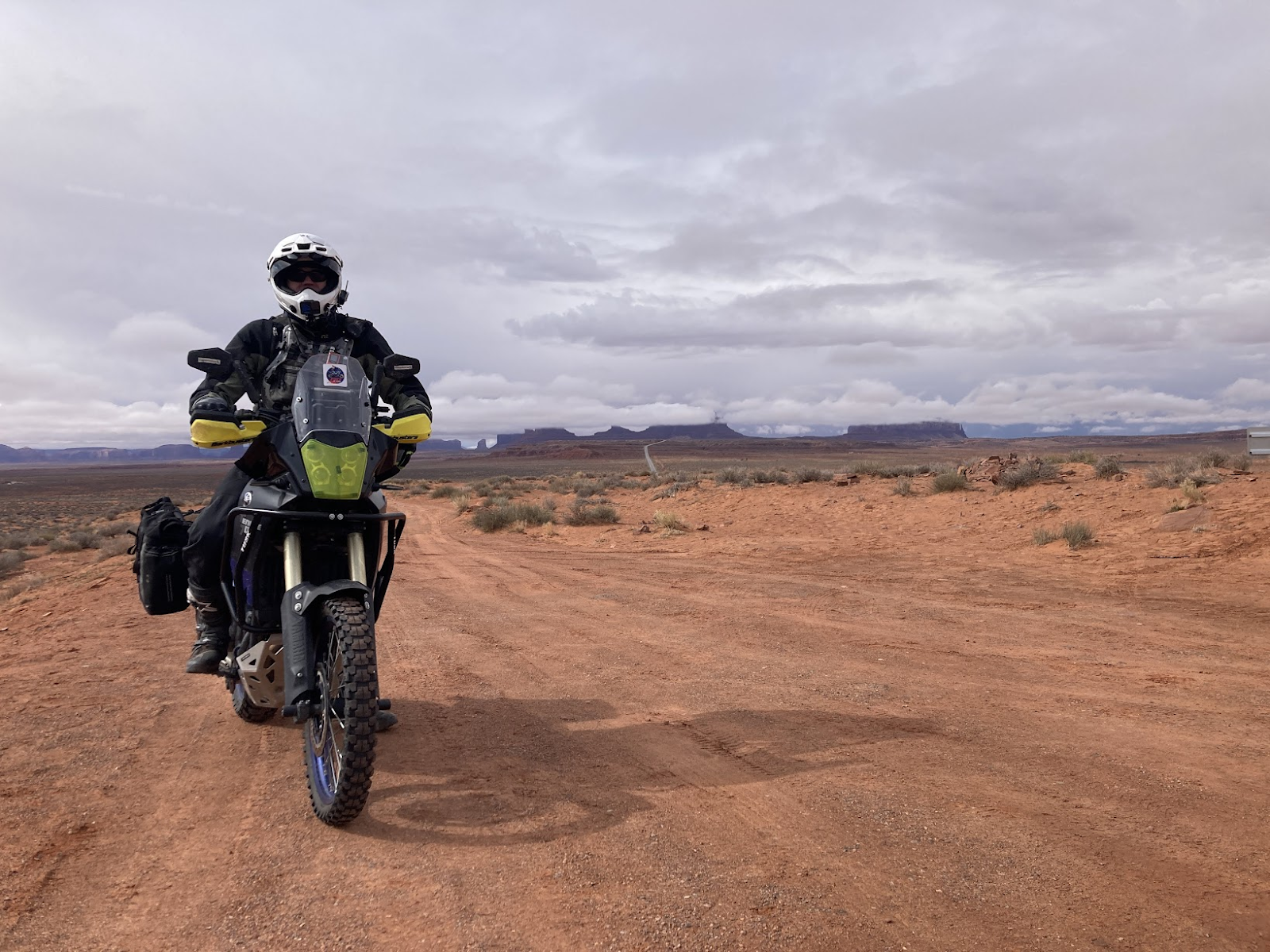
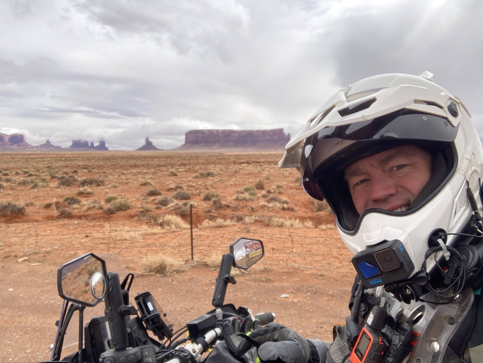
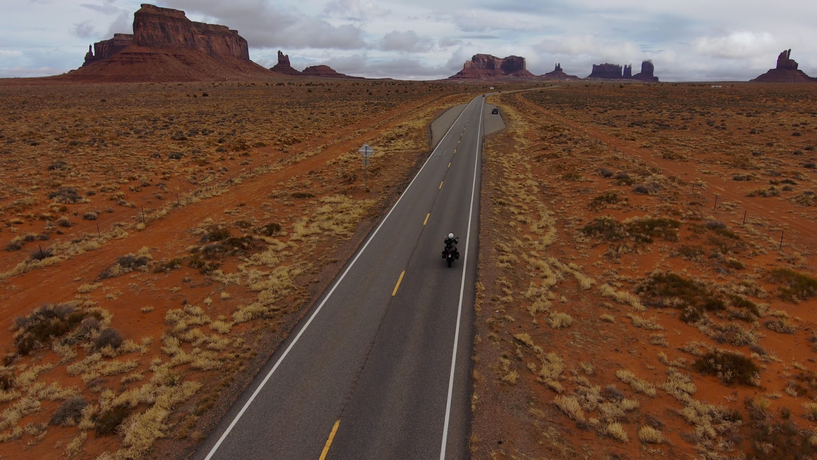
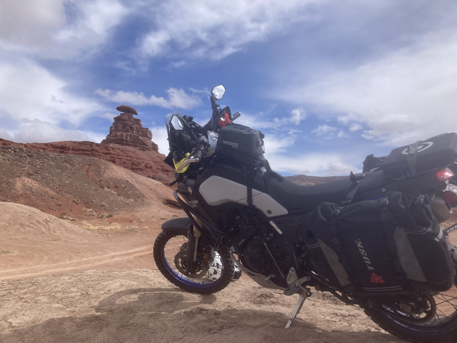
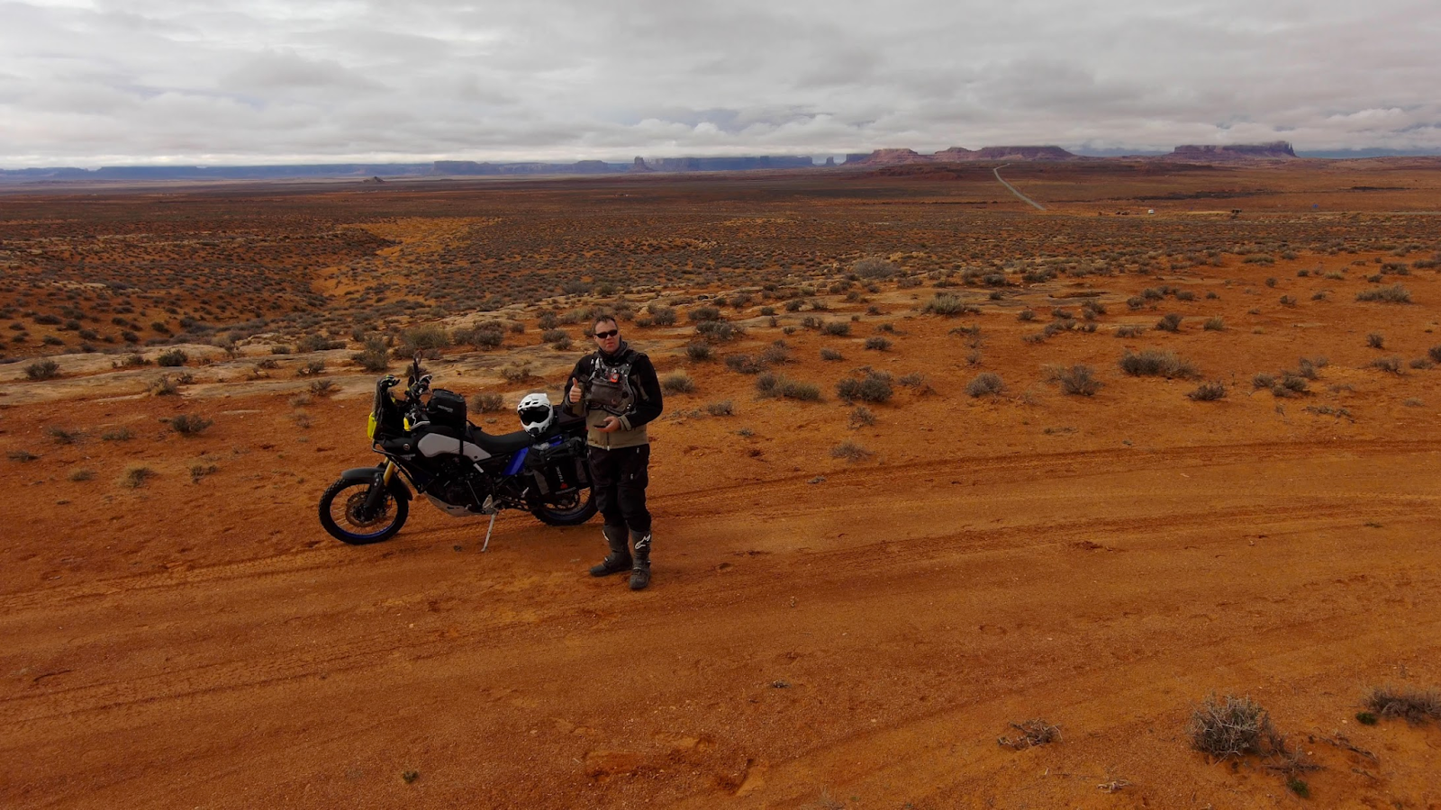
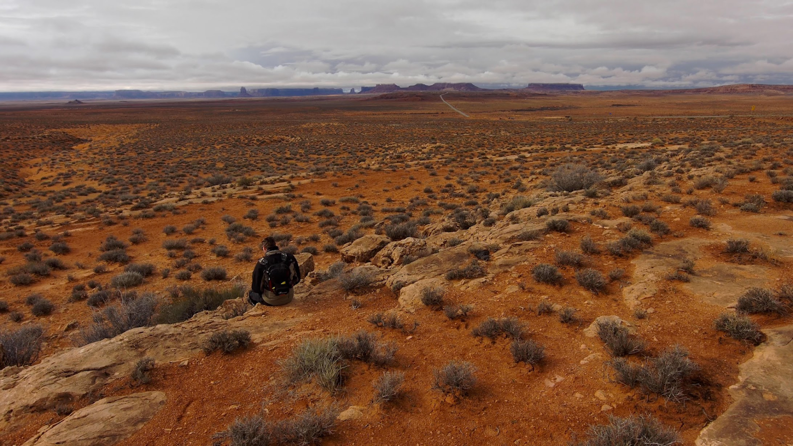
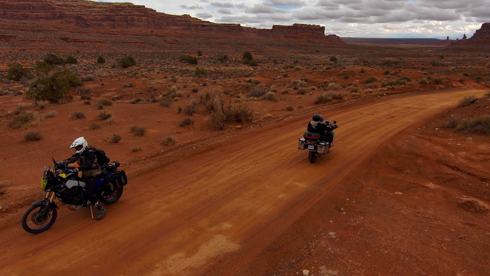
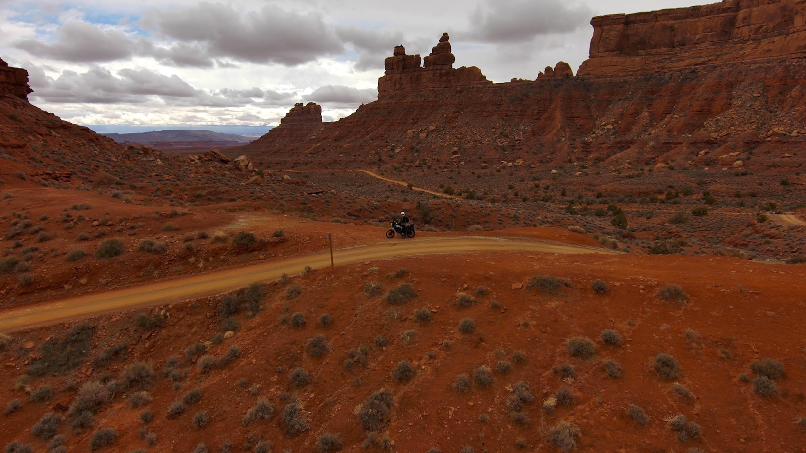
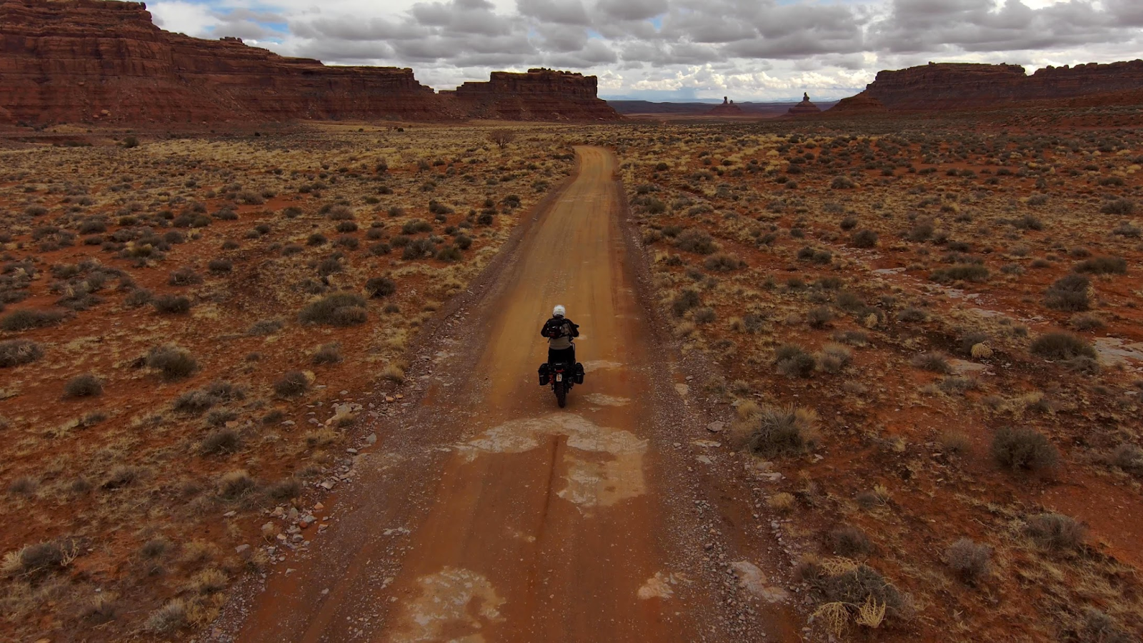
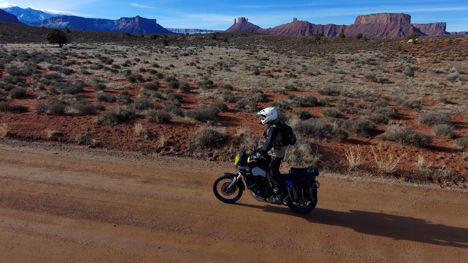
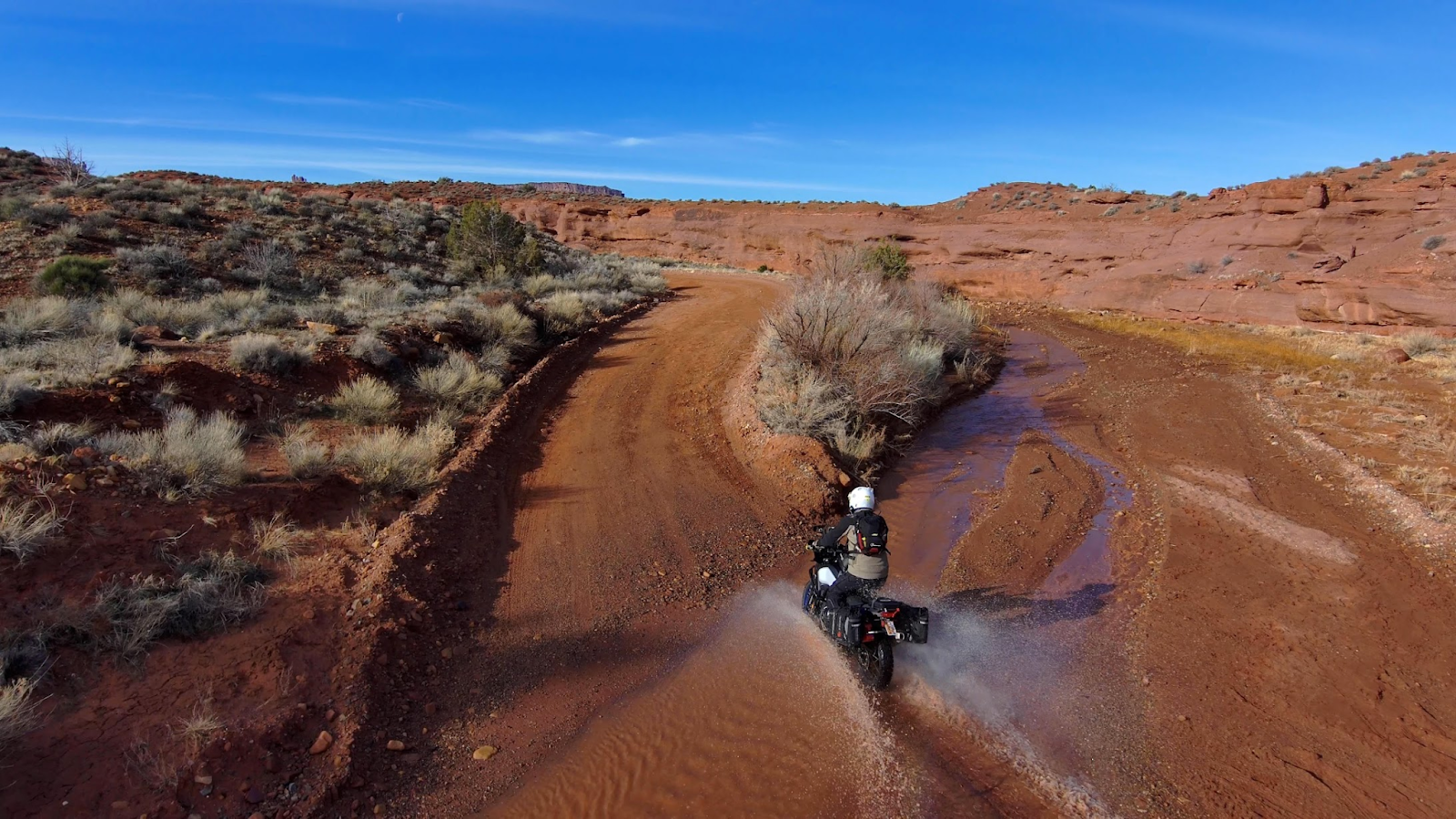
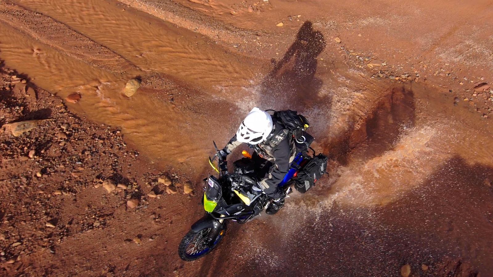
ROUTE DESC: Solo Adventure Motorcycle Riding around Moab including Monument Valley and parts of the Utah BDR
RECAP/SUMMARY/Ride Reflections:
I just returned from 40 hours in the wilderness not much fasting...but solo survival trip on my large dual sport bike. Its weird, but this is how I RENEW, I listened to most of Jordan Peterson's bible series while I road. I survived 23 degrees at 70 mph, scary road conditions (slippery left moab about 7:30am and the road looked wet, I stopped on the sid eof the road and a growler strips had ice in them!), snow storms, rain, sand, mud and 12 hours of cold on a bike. I hit monument valley(Yawn), valley of the Gods(My fav on this trip), Castle Valley, parts of onion creek and Utah BDR (Back country discovery route), La Sal loop, arches and a secret dirt road out of arches into willow springs.
I love Moab in the winter its nice and cool. My sis and I hit canyon lands for a cool sunset (she is there all week with her photo nerds taking lots of cool photos). My closest call was almost hitting a full sized cow at high speeds in the dark...emergency braking and then swerving behind the cow. I should go eat a large steak after that close call! A few pics > https://photos.app.goo.gl/9yQEGaTGh5YT931X7
Prayers were answered especially in the snow storm.
LEVEL: 1 noob on a small ish bike. Level2: skilled rider on smallish bike. Level 3: extremely difficult trail from an experienced riders perspective.Needing buddies in case things go wrong and to help get through challenges.
FLOW TEST is a very simple dirt bike, dual sport, and ADV trail ranking system, which measures the following criteria on a scale of 0 to 5, 5 being the most difficult:
F - Fatigue (5=hard enduro like erzberg)
L - Length (time)
O - Obstacles (5% of riders can do 5 level)
W - Width (0=blacktop 1= dirt road where two cars can pass, 3=dual track, 5=width of dirtbike tire)
Two scores - common and highest
T - Traction (5=extremely slick mud)
E - Exposure (Cliffs 5=a mistake is certain death)
S - Steepness (1 point per 10% degrees -- 30 degrees=3)
T - Technical Terrain (opposite of flowing trail-- erzberg challenges would be 4, some pieces 5)
All points CAN be summed up.
RATING THIS TRAIL: I’d say easy except the ice potential Monday AM. I stopped and waited for it to warm up a bit. It was 34 degrees most of the trip with a wet looking road, but it did dip down to 23 degrees in some places. The snow in the face shield was hard to see. I did get into mud and being solo it wasn’t too bad, but I didn’t want to do 20 miles of mud, so after 1 or 2 miles I turned back and went some where else.
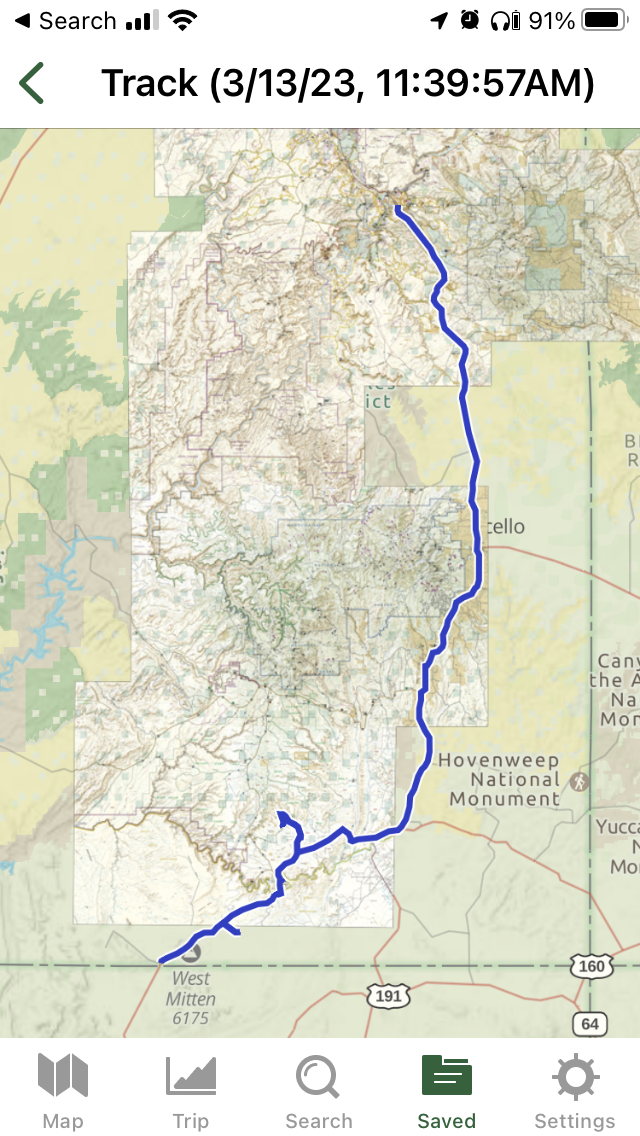
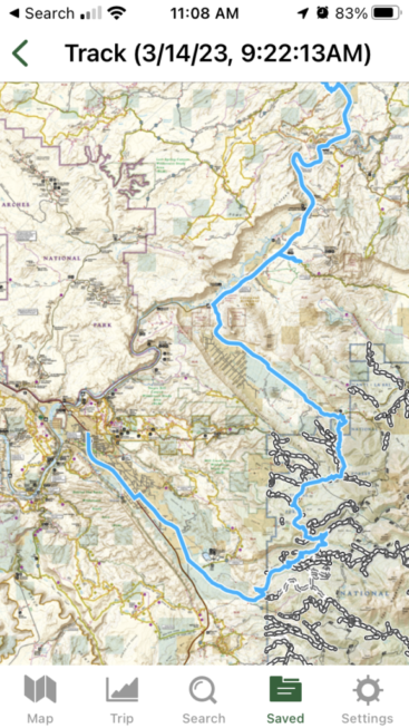
DATE: March 13-14, 2023
SCREENSHOT OF ROUTE:
Monday: To monument valley >
Tuesday onion creek, castle valley, La Sal loop:
Tues Arches exploring, including 7.7 mile road from arches to willow springs:
LINK TO ROUTE:
Monument Valley, Valley of the Gods:
https://www.gaiagps.com/public/2CI3Fx2eKYayp3S8G5Ie3MVm
Tuesday onion creek, castle valley, La Sal loop:
https://www.gaiagps.com/public/Hw0ulctFFxElm7lXS0Og8wBe
Tues Arches exploring, including 7.7 mile road from arches to willow springs:
https://www.gaiagps.com/public/QkHdOKj7fllrjzuceAZBYiKl
LINK TO VIDEO:
GEAR REVIEW: mosko moto basilisk pant
I finally tested them on my ride in and around Moab. I found my knee braces barely had room in the pants and Its hard tos wing on/off the bike, so I have to use the footpeg and usually I'm good to go at 6'5". I have pretty skinny legs.
The main problem is they scratch my Tenere 700! I don't know if this is common? I've had a dozen klim pants and none have scratched the sides of the bike and tank. I should get you a photo.
The Basilisk pant scratched my tenere 700 gas tank and sides!
My t7 has 22,000 miles and a bunch of scratches so likely not the end of the world, but makes me think twice before using the basilisk pant. I think I might put some black gaffer tape on the dragon skin edge the rubs on my bike.
Other than those two issues, they are awesome!
SCREENSHOTS:
Near monument valley
Monument Valley
Mexican Hat
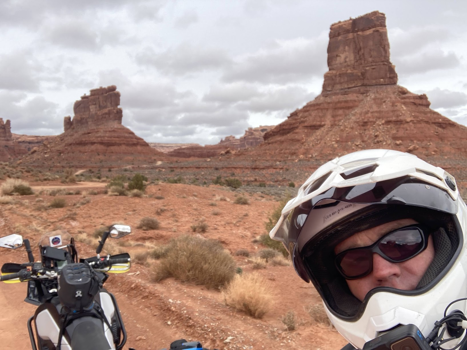
Valley of the Gods
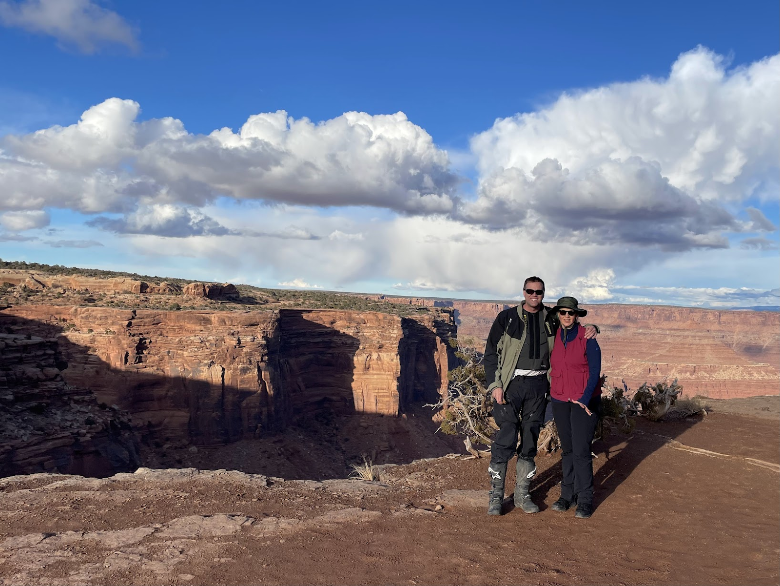
Canyon Lands near Shafer Trail

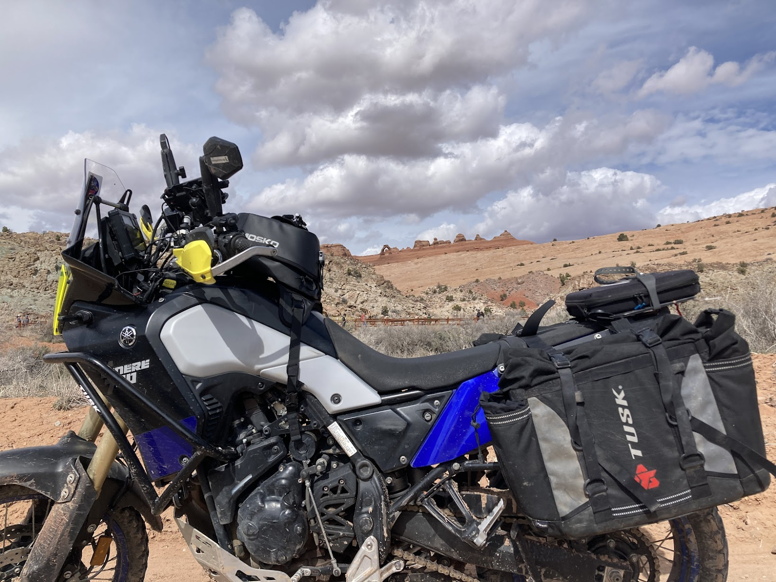
Arches - Delicate Arch
Valley of the Gods
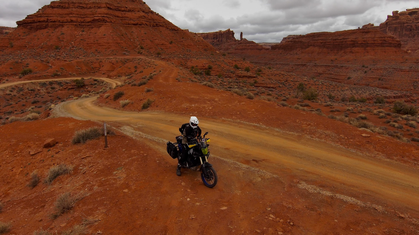
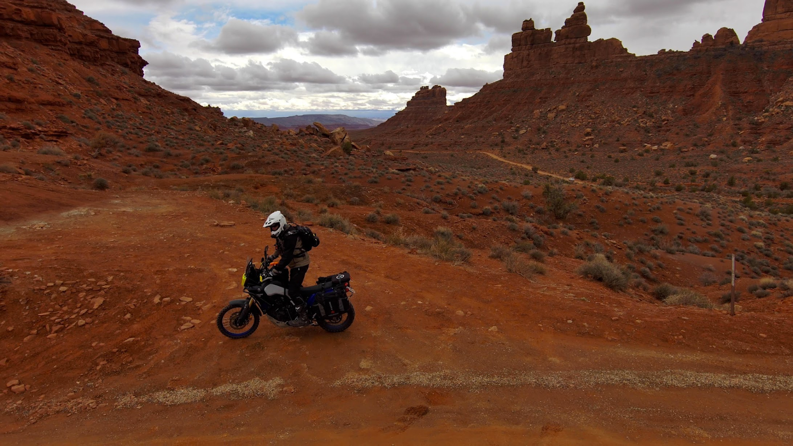
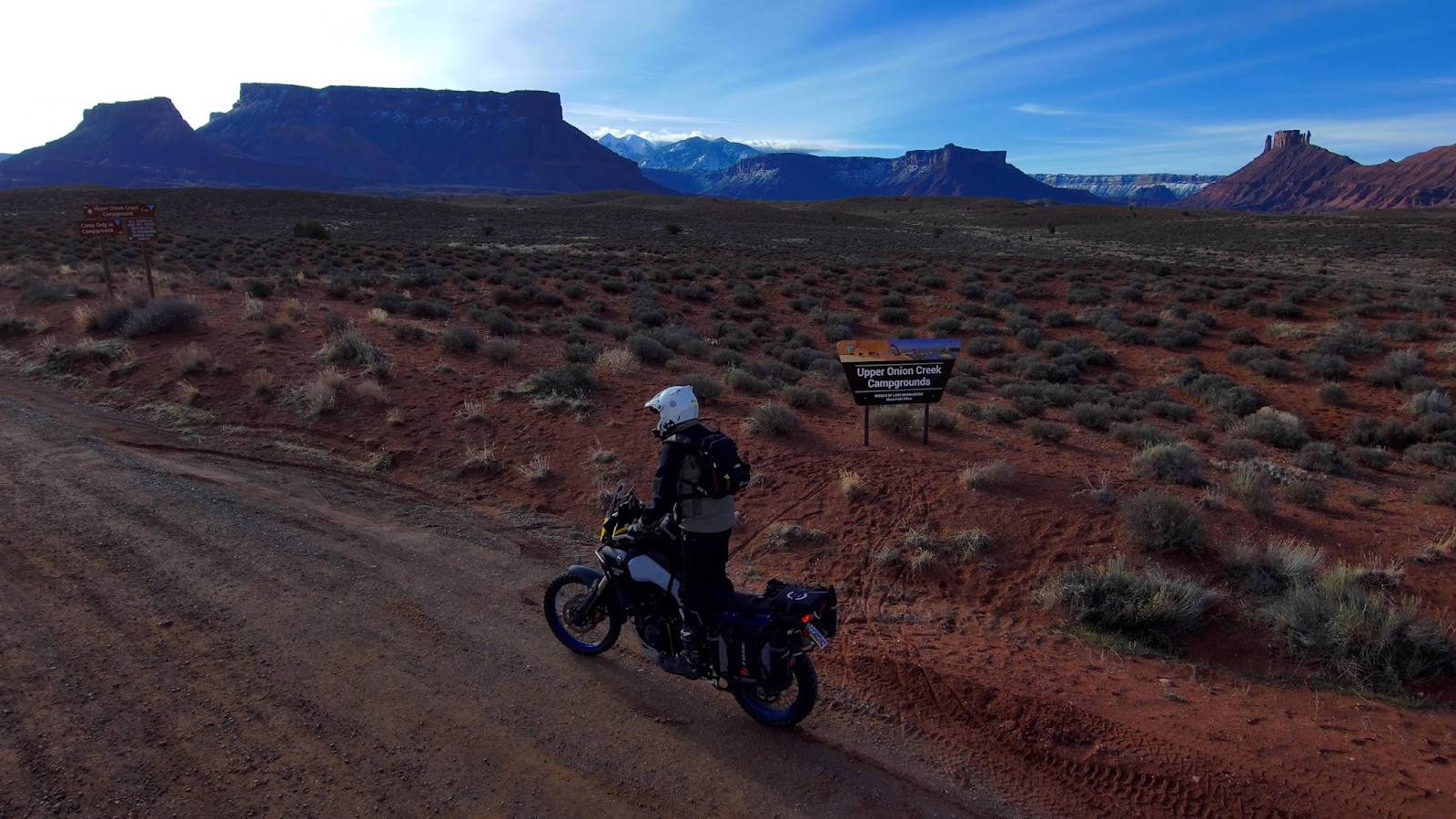
Onion Creek
TEMPLATE
ROUTE DESC:
RECAP/SUMMARY/Ride Reflections:
LEVEL: 1 noob on a small ish bike. Level2: skilled rider on smallish bike. Level 3: extremely difficult trail from an experienced riders perspective.Needing buddies in case things go wrong and to help get through challenges.
FLOW TEST is a very simple dirt bike, dual sport, and ADV trail ranking system, which measures the following criteria on a scale of 0 to 5, 5 being the most difficult:
F - Fatigue (5=hard enduro like erzberg)
L - Length (time)
O - Obstacles (5% of riders can do 5 level)
W - Width (0=blacktop 1= dirt road where two cars can pass, 3=dual track, 5=width of dirtbike tire)
Two scores - common and highest
T - Traction (5=extremely slick mud)
E - Exposure (Cliffs 5=a mistake is certain death)
S - Steepness (1 point per 10% degrees -- 30 degrees=3)
T - Technical Terrain (opposite of flowing trail-- erzberg challenges would be 4, some pieces 5)
All points CAN be summed up.
RATING THIS TRAIL: xyz
DATE:
SCREENSHOT OF ROUTE:
LINK TO ROUTE:
LINK TO VIDEO:
SCREENSHOTS:
GEAR REVIEW:
RECAP/SUMMARY/Ride Reflections:
LEVEL: 1 noob on a small ish bike. Level2: skilled rider on smallish bike. Level 3: extremely difficult trail from an experienced riders perspective.Needing buddies in case things go wrong and to help get through challenges.
FLOW TEST is a very simple dirt bike, dual sport, and ADV trail ranking system, which measures the following criteria on a scale of 0 to 5, 5 being the most difficult:
F - Fatigue (5=hard enduro like erzberg)
L - Length (time)
O - Obstacles (5% of riders can do 5 level)
W - Width (0=blacktop 1= dirt road where two cars can pass, 3=dual track, 5=width of dirtbike tire)
Two scores - common and highest
T - Traction (5=extremely slick mud)
E - Exposure (Cliffs 5=a mistake is certain death)
S - Steepness (1 point per 10% degrees -- 30 degrees=3)
T - Technical Terrain (opposite of flowing trail-- erzberg challenges would be 4, some pieces 5)
All points CAN be summed up.
RATING THIS TRAIL: xyz
DATE:
SCREENSHOT OF ROUTE:
LINK TO ROUTE:
LINK TO VIDEO:
SCREENSHOTS:
>>>