2016 PG&E Fuel Reduction Grants


Marin-05: Forest Way Eucalyptus Removal
Project Information
PG&E Project number | Marin-05 |
Type of Project | Fuel Reduction |
Location | 37.88008, -122.54915 |
Size of the project | .865 acres |
Proximity to PG&E Equipment | 0’-100’ |
Project Award | $27,500 |
Project Description and Fuel Reduction Strategies
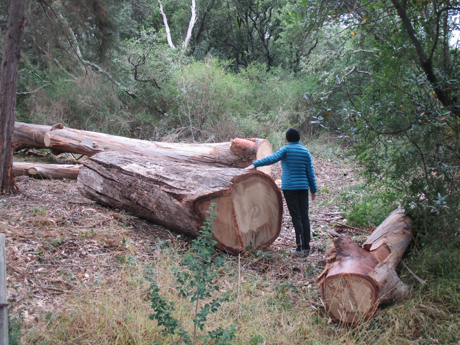
Project consisted of removal of small eucalyptus grove (three large and about 20 small trees) at/around PG&E power pole and threatening PG&E main line. Trees were cut, debris removed, and stumps treated on Golden Gate National Recreation Area (GGNRA; a unit in the National Park Service) property. GGNRA personnel were involved project planning and agreed to the scope of work.
Work for this project started on July 18, 2016; the project consisted of 3 phases.
A crew from the Conservation Corps North Bay (CCNB) spent several days clearing and disposing of brush-type vegetation (mostly French broom with some pampas grass) as well as removing ‘duff’ (branches, eucalyptus bark, etc.).
Eucalyptus were removed by a licensed tree-service (see note below regarding the one remaining eucalyptus). Smaller material was chipped on-site (with agreement from GGNRA personnel); the larger logs were hauled away for disposal.
CCNB removed additional brush-type vegetation in order to expand and extend the cleared area (i.e. the ‘footprint’ of the area), completing work on September 28, 2016.
GGNRA will maintain the project area in the future, to include spreading the piles of chips and, gradual removal and limbing-up of the remaining evergreens (Monterey pines and Monterey Cypress).
NOTE: There is one remaining eucalyptus on the site. Based on recommendation from PG&E personnel, the decision was to leave this tree since it was too close to the utility pole and the overhead wires.
Project Map
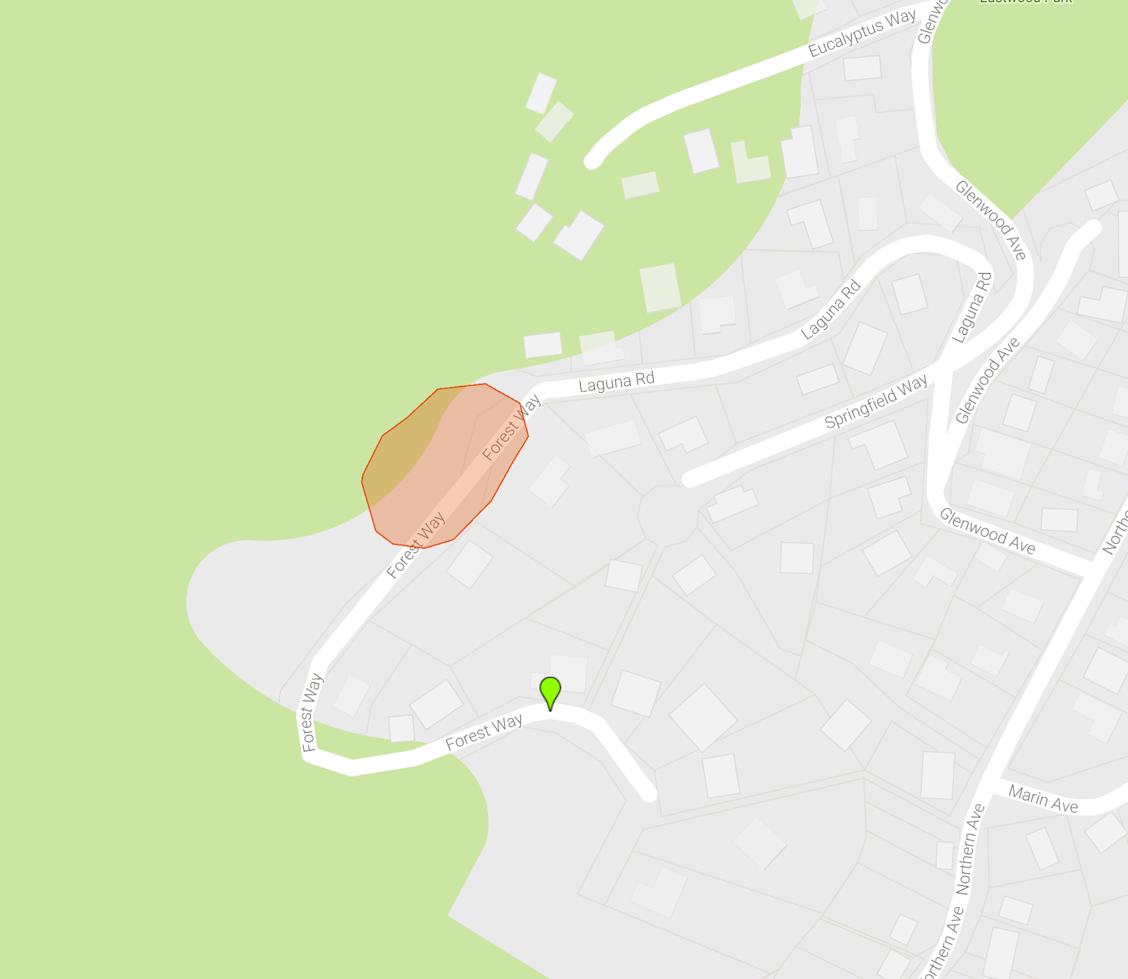
Figure 1: Map of the Forest Way Eucalyptus Removal in Tamalpais Valley, near Mill Valley, CA.
View Detailed Map Online: https://drive.google.com/open?id=1t2uCDMjtLwVzlvvV0ZK8qiomo_o&usp=sharing

Project Photography
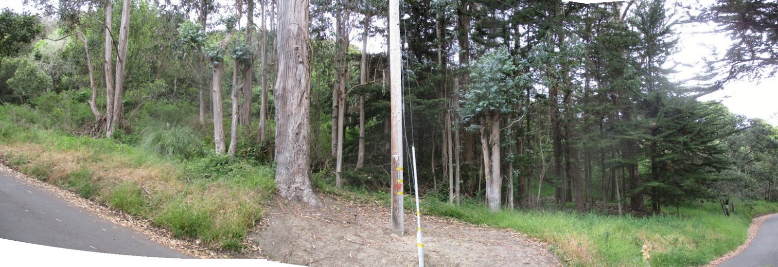
Before
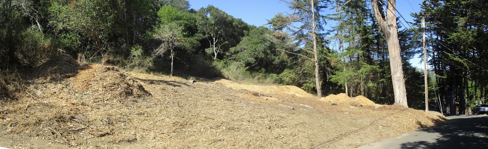
Panoramic photos taken from near the southeastern corner of the project area.
“Before” photo (May 27, 2016)

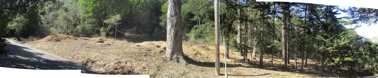
After
“After” photo (September 29, 2016)

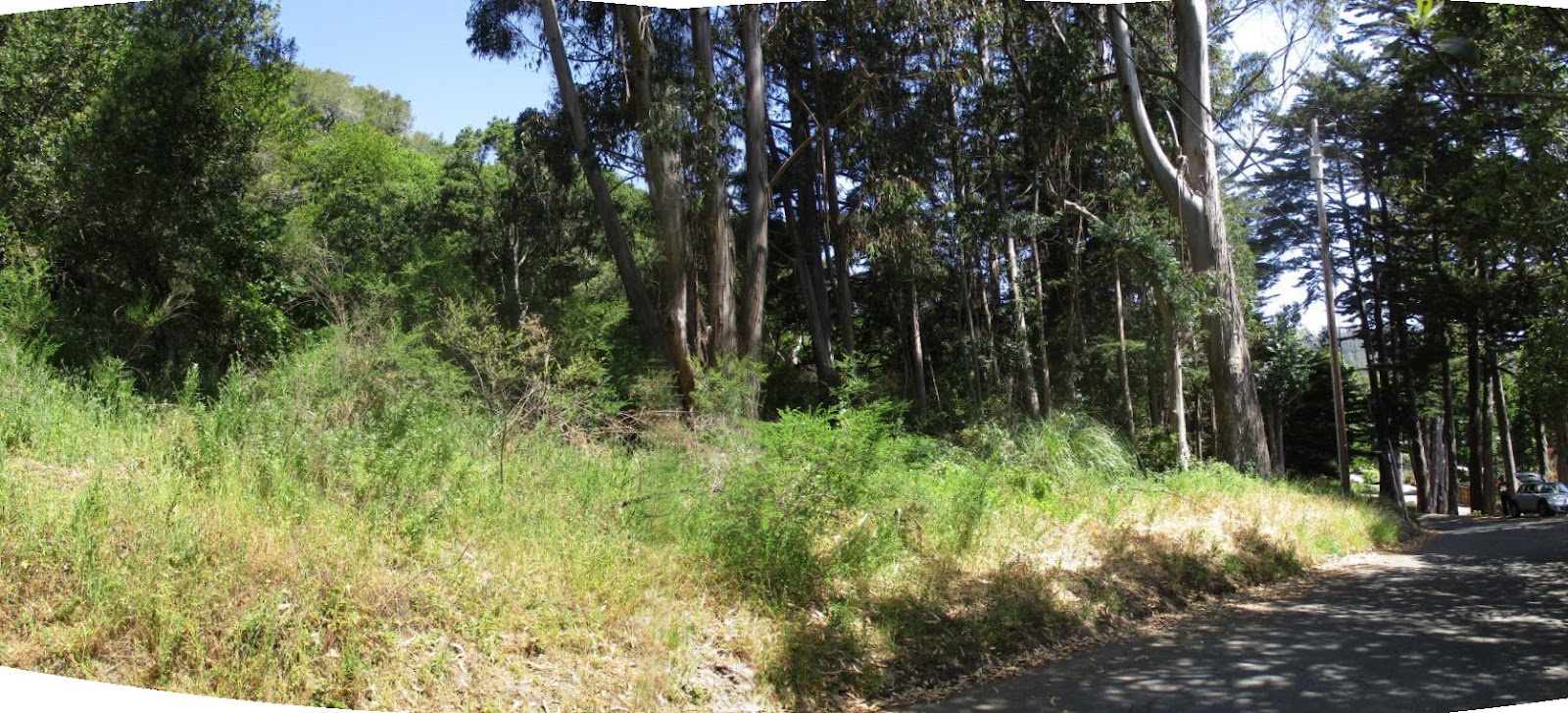
Before
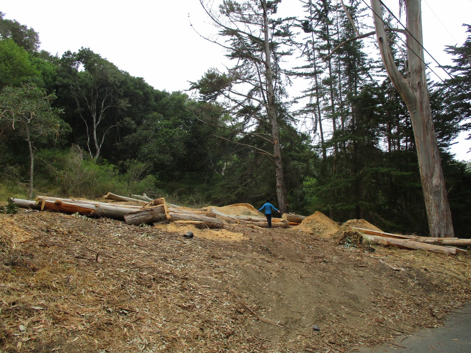
Panoramic photos taken near to and across from the middle of the project area.
“Before” photo (May 27, 2016)

After
“After” photo (September 29, 2016)

Before
Panoramic photos taken from near the northeastern corner of the project area.
“Before” photo (May 27, 2016)

After
“After” photo (September 29, 2016)

Before
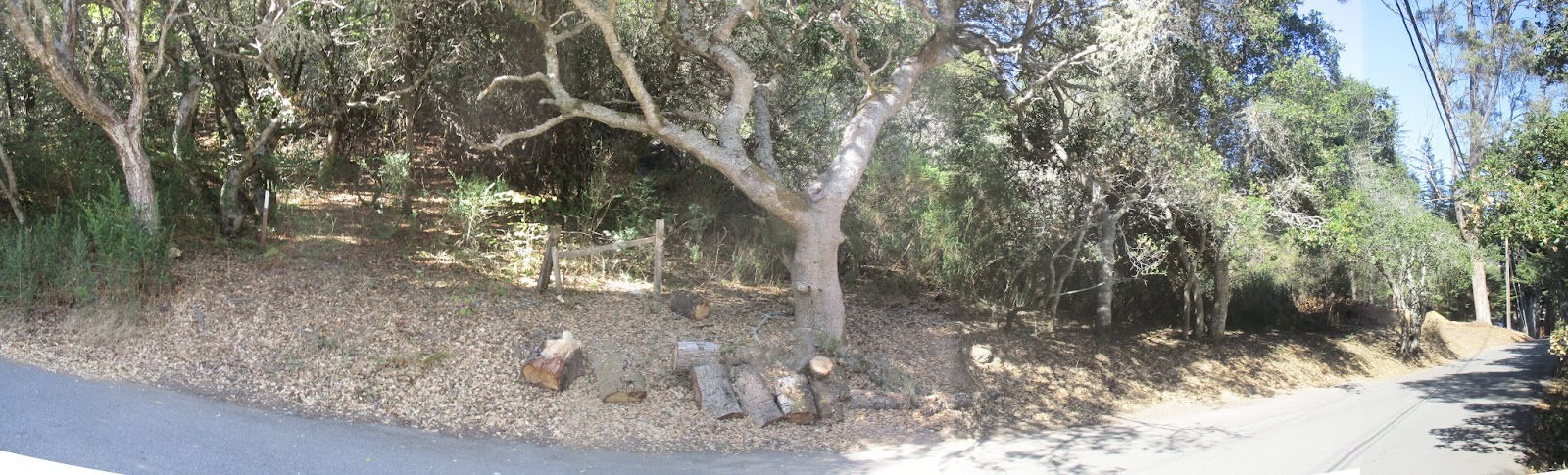
Panoramic photos taken of roadside south of the primary work area.
“Before” photo (August 17, 2016)

After
“After” photo (September 29, 2016)

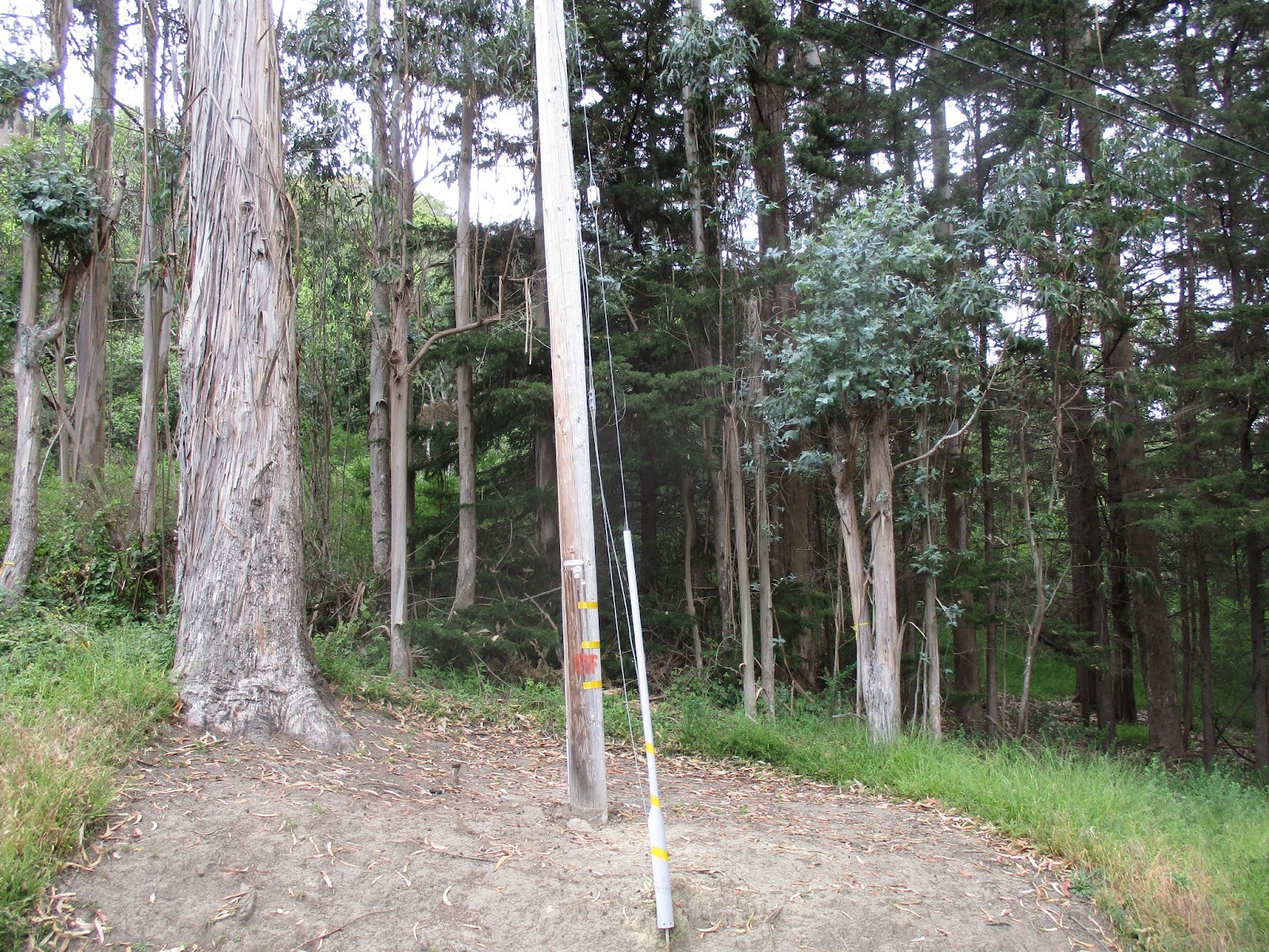
After
Photos of remaining eucalyptus
Photo of remaining euc taken 05/27/2016 (from across from utility pole) | Photo of remaining euc taken 09/29/2016 (from across from utility pole) | Photo of remaining euc taken 09/29/2016 (Photo of most of the tree) |
Example of a ‘stem’ | ‘Stems’ prior to removal |


During